MyTopo
Tenderfoot Lake Wisconsin US Topo Map
Couldn't load pickup availability
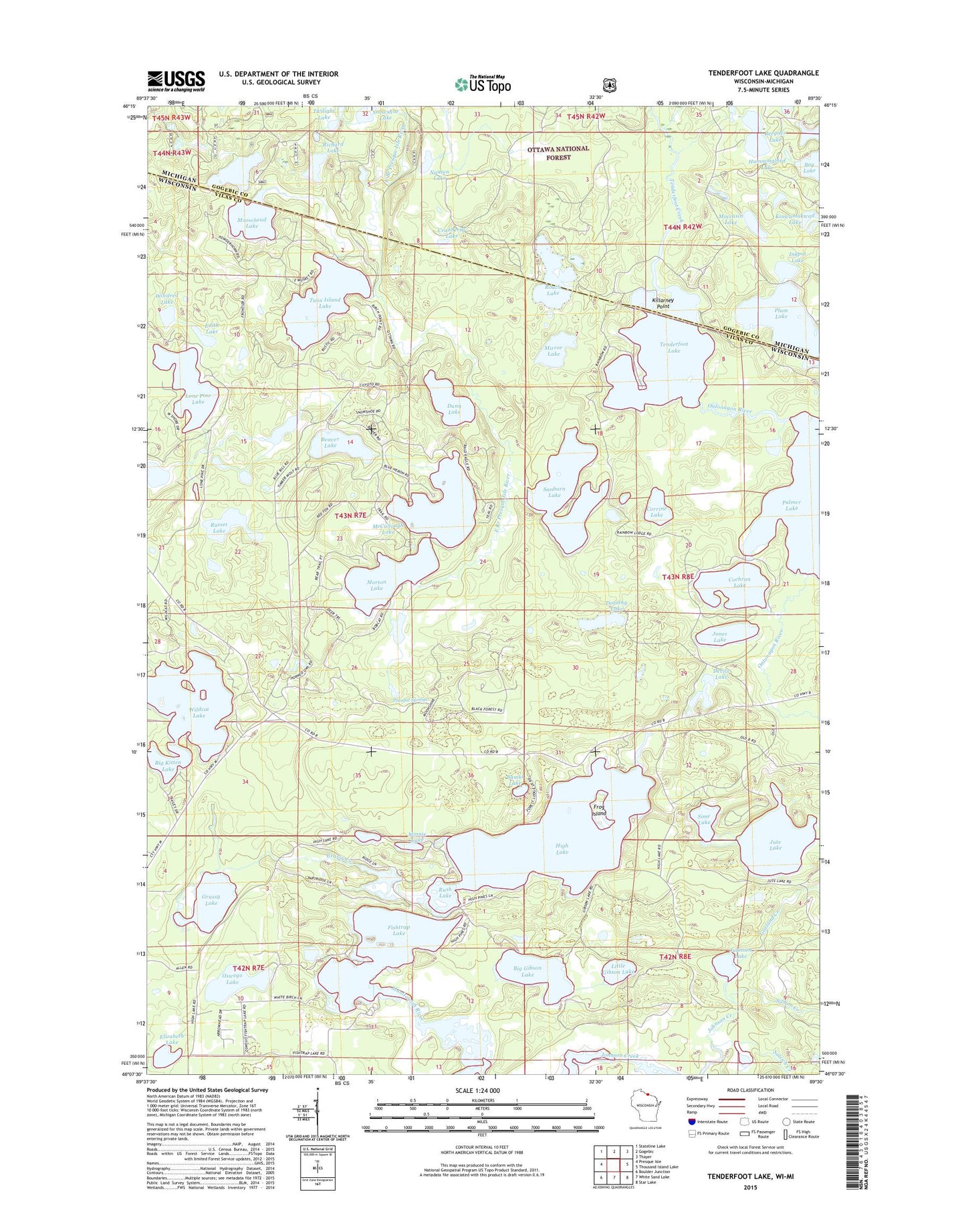
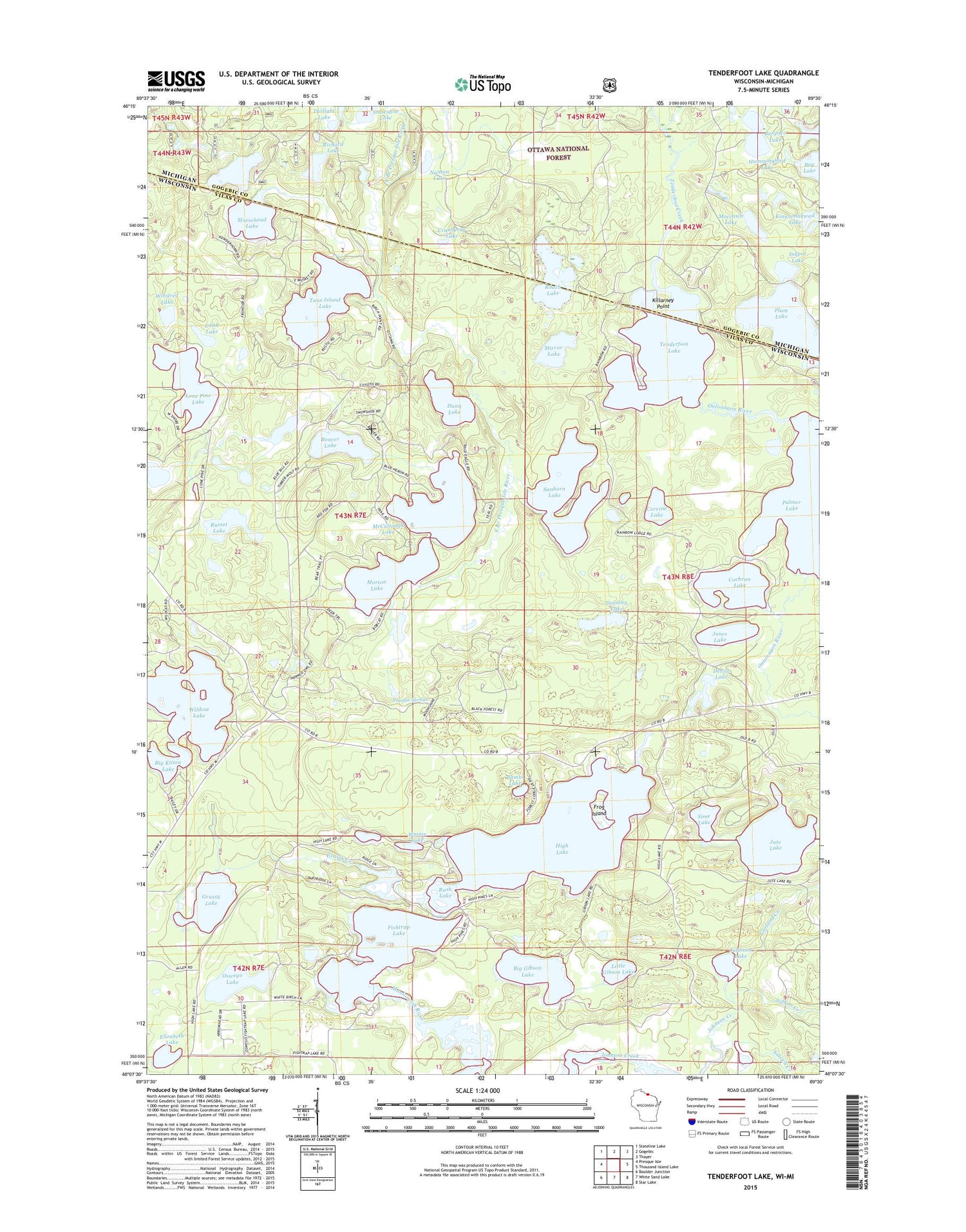
2018 topographic map quadrangle Tenderfoot Lake in the states of Wisconsin, Michigan. Scale: 1:24000. Based on the newly updated USGS 7.5' US Topo map series, this map is in the following counties: Vilas, Gogebic. The map contains contour data, water features, and other items you are used to seeing on USGS maps, but also has updated roads and other features. This is the next generation of topographic maps. Printed on high-quality waterproof paper with UV fade-resistant inks.
Quads adjacent to this one:
West: Presque Isle
Northwest: Stateline Lake
North: Gogebic
Northeast: Thayer
East: Thousand Island Lake
Southeast: Star Lake
South: White Sand Lake
Southwest: Boulder Junction
Contains the following named places: Bambi Lake, Beaver Lake, Bergner Lake, Big Gibson Lake, Big Kitten Lake, Cochran Lake, Corrine Lake, Cranberry Lake, Devils Lake, Dorothy Lake, Dunn Lake, Dunn Lake State Natural Area, Edith Lake, Elizabeth Lake, Fishtrap Lake, Frog Island, Garland Creek, Grassy Creek, Grassy Lake, High Lake, High Lake Spruce-Balsam Forest State Natural Area, Hummingbird Lake, Inkpot Lake, Johnson Lake, Johnson Lake Barrens State Natural Area, Jones Lake, Jute Lake, Killarney Point, Little Gibson Lake, Little Jute Lake, Little Presque Isle Lake, Lone Pine Lake, McCullough Lake, Minnie Lake, Mirror Lake, Moccasin Lake, Moosehead Lake, Moosehead Lake Campground, Morton Lake, Mud Lake, Nansen Lake, Notre Dame Church, Ontonagon River, Oswego Lake, Plum Lake, Presque Springs, Richard Lake, Roach Lake, Rush Lake, Russet Lake, Salsich Creek, Sanborn Lake, Sime Lake, Siphon Creek, Tenderfoot Lake, Twilight Lake, Twin Island Lake, Wildcat Lake, Winifred Lake