MyTopo
Wauzeka East Wisconsin US Topo Map
Couldn't load pickup availability
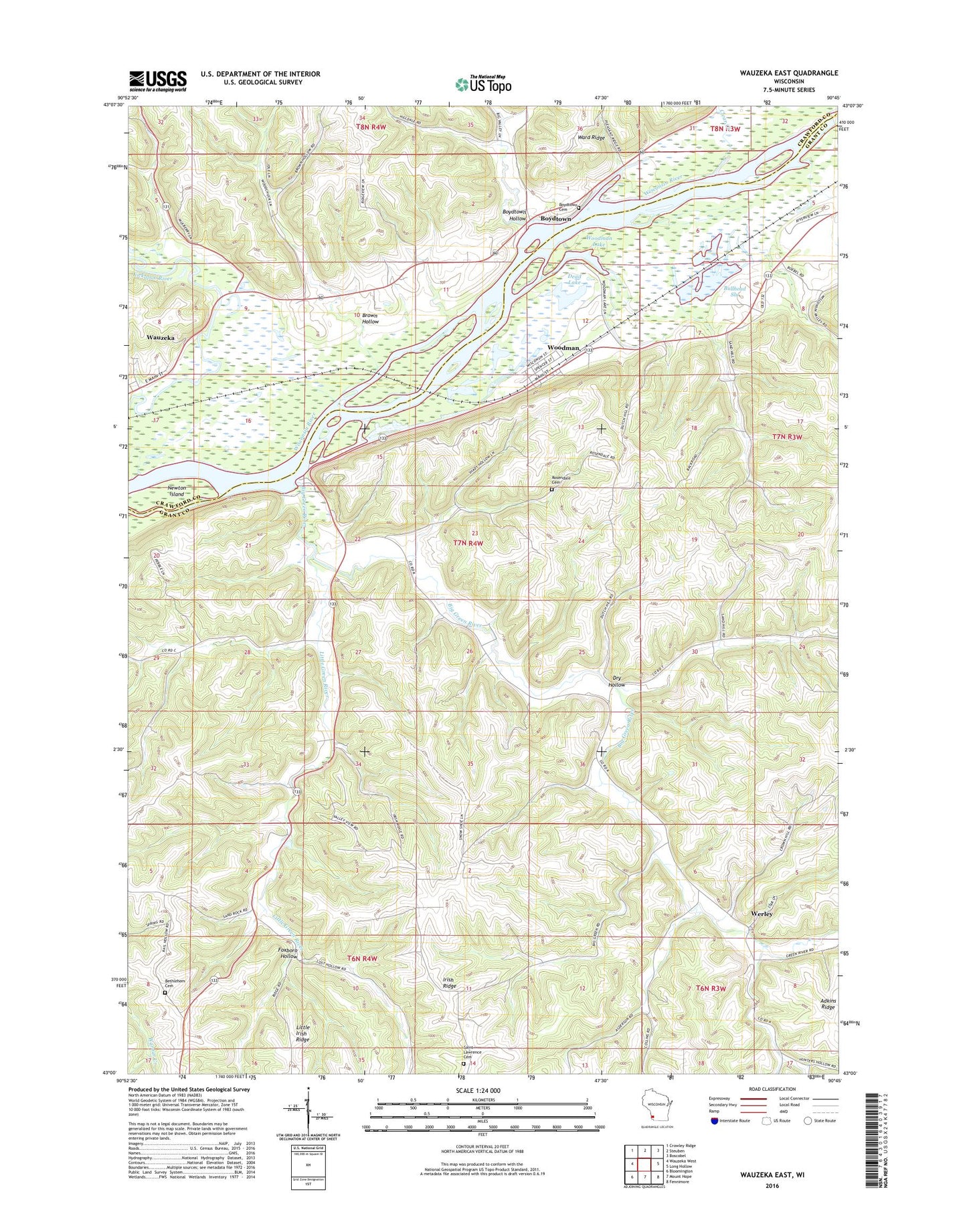
2018 topographic map quadrangle Wauzeka East in the state of Wisconsin. Scale: 1:24000. Based on the newly updated USGS 7.5' US Topo map series, this map is in the following counties: Grant, Crawford. The map contains contour data, water features, and other items you are used to seeing on USGS maps, but also has updated roads and other features. This is the next generation of topographic maps. Printed on high-quality waterproof paper with UV fade-resistant inks.
Quads adjacent to this one:
West: Wauzeka West
Northwest: Crowley Ridge
North: Steuben
Northeast: Boscobel
East: Long Hollow
Southeast: Fennimore
South: Mount Hope
Southwest: Bloomington
Contains the following named places: Bethlehem Cemetery, Big Green River, Blue Rock Kanyon Ranch, Boydtown, Boydtown Cemetery, Boydtown Hollow, Brown Hollow, Bullhead Slough, Clear Creek, Dead Lake, Dry Hollow, Foxboro Hollow, Green River School, Little Green River, Mount Hope Pond State Wildlife Area, Newton Island, Rosendale Cemetery, Saint Lawrence Church, Saint Lawrence O'Toole Catholic Church Cemetery, Schauff Family Dairy, Town of Woodman, Village of Woodman, Wauzeka Bottoms State Natural Area, Werley, Woodman, Woodman Lake, Woodman Lake Sand Prairie and Dead Lake State Natural Area, ZIP Code: 53827