MyTopo
Wauzeka West Wisconsin US Topo Map
Couldn't load pickup availability
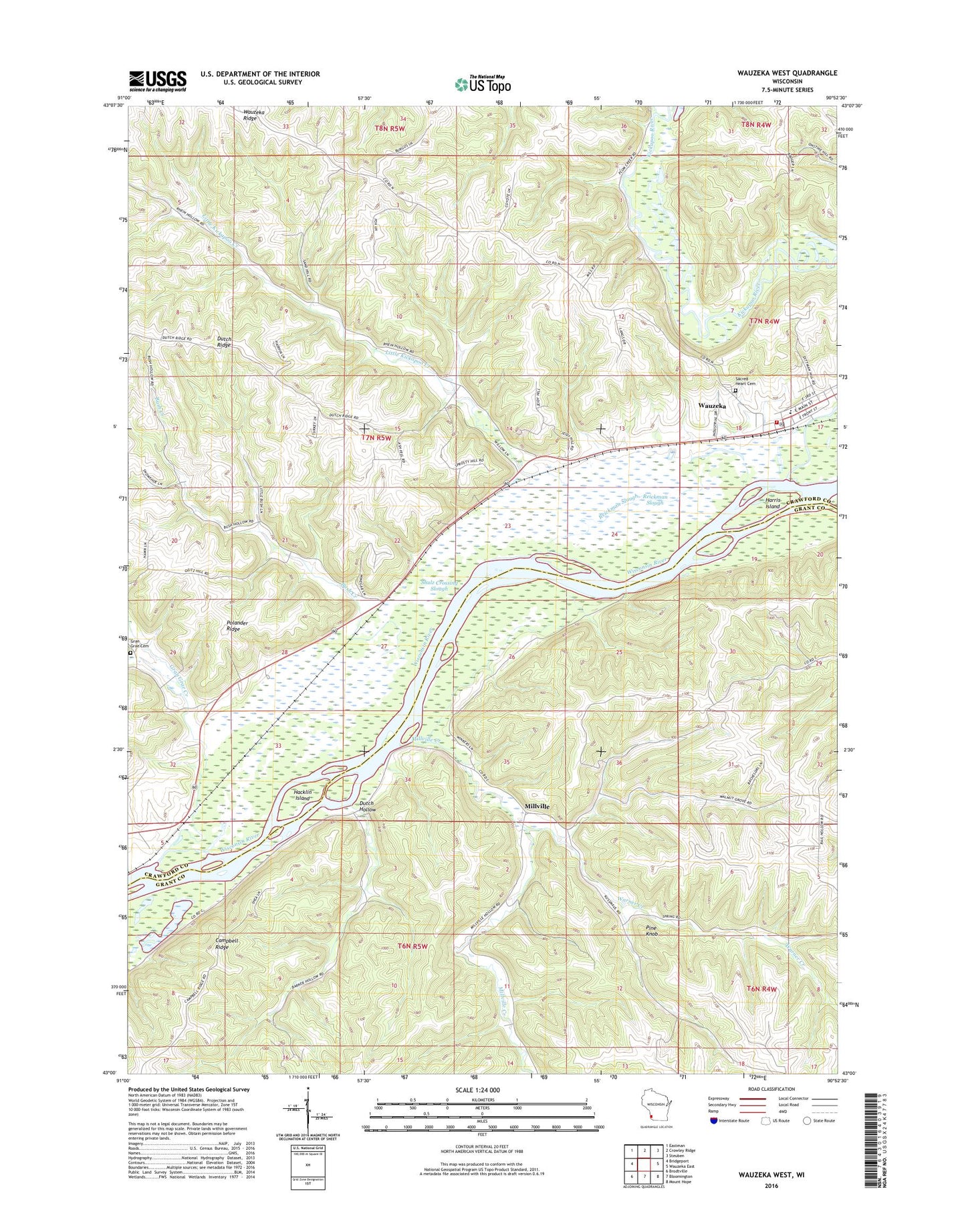
2018 topographic map quadrangle Wauzeka West in the state of Wisconsin. Scale: 1:24000. Based on the newly updated USGS 7.5' US Topo map series, this map is in the following counties: Crawford, Grant. The map contains contour data, water features, and other items you are used to seeing on USGS maps, but also has updated roads and other features. This is the next generation of topographic maps. Printed on high-quality waterproof paper with UV fade-resistant inks.
Quads adjacent to this one:
West: Bridgeport
Northwest: Eastman
North: Crowley Ridge
Northeast: Steuben
East: Wauzeka East
Southeast: Mount Hope
South: Bloomington
Southwest: Brodtville
Contains the following named places: Adiantum Woods State Natural Area, Bush Creek, Dutch Hollow, Dutch Ridge, Gran Grae Cemetery, Gran Grae Creek, Gran Grae School, Hacklin Island, Harris Island, Kickapoo River, Little Kickapoo Creek, Millville, Millville Creek, Pine Knob, Plum Creek, Polander Ridge, Reickman Slough, Rider School, Schurz School, Shulz Crossing Slough, Town of Millville, Town of Wauzeka, Village of Wauzeka, Warner Creek, Wauzeka, Wauzeka Cemetery, Wauzeka Elementary School, Wauzeka Middle School, Wauzeka Post Office, Wauzeka Ridge, Wauzeka Ridge School, Wauzeka Steuben School District, Wauzeka Volunteer Fire and Rescue, Wauzeka Wastewater Treatment Facility, ZIP Code: 53826