MyTopo
Westfield West Wisconsin US Topo Map
Couldn't load pickup availability
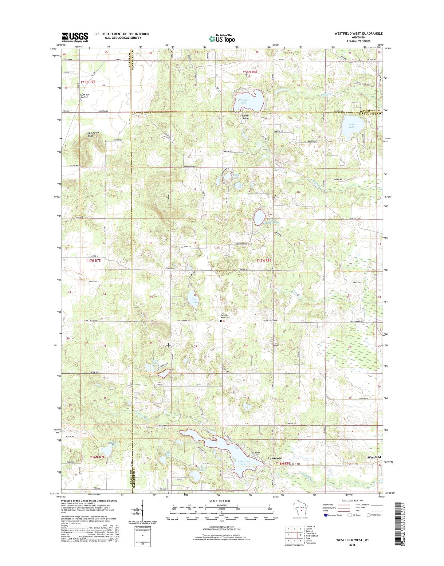
2018 topographic map quadrangle Westfield West in the state of Wisconsin. Scale: 1:24000. Based on the newly updated USGS 7.5' US Topo map series, this map is in the following counties: Marquette, Adams, Waushara. The map contains contour data, water features, and other items you are used to seeing on USGS maps, but also has updated roads and other features. This is the next generation of topographic maps. Printed on high-quality waterproof paper with UV fade-resistant inks.
Quads adjacent to this one:
West: Grand Marsh
Northwest: Coloma SW
North: Coloma
Northeast: Richford
East: Westfield East
Southeast: Packwaukee
South: Oxford
Southwest: Brooks
Contains the following named places: Camp Firewood, Chaffee Creek State Fishery Area, Echo Lake, Hillview Christmas Tree Farm, Horseshoe Bluff, Lake Burnita, Lawrence, Lawrence Creek, Lawrence Creek State Natural Area, Lawrence Creek State Wildlife Area, Lawrence Dam, Lawrence Lake, Lawrence Lake 29, Pilot Knob, Pine Lake, Pine Lake Camp, Pleasant Lake, Pleasant View Cemetery, Pockrandt Quarry, Riverside Cemetery, Rollers Lake, Sandow Lake, School Section Lake, South Burr Oak Cemetery, South Burr Oak Church, Springfield Township Fire Department, Sunset Point, Town of Springfield, Twin Lakes, Wood Lake, ZIP Code: 53964