MyTopo
Wheeler Wisconsin US Topo Map
Couldn't load pickup availability
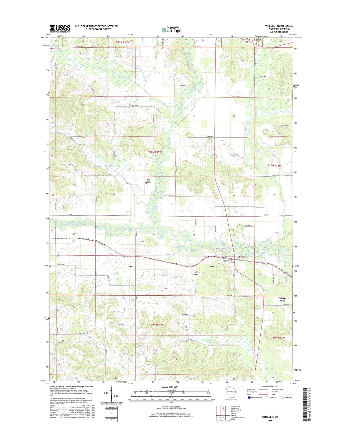
2018 topographic map quadrangle Wheeler in the state of Wisconsin. Scale: 1:24000. Based on the newly updated USGS 7.5' US Topo map series, this map is in the following counties: Dunn. The map contains contour data, water features, and other items you are used to seeing on USGS maps, but also has updated roads and other features. This is the next generation of topographic maps. Printed on high-quality waterproof paper with UV fade-resistant inks.
Quads adjacent to this one:
West: Boyceville
Northwest: Connorsville
North: Ridgeland
Northeast: Ridgeland NE
East: Norton
Southeast: Rusk
South: Menomonie North
Southwest: Knapp
Contains the following named places: Baxter, Big Beaver Creek, Big Beaver Creek State Public Hunting Ground, Blairmoor Branch, Church of the Nazarene, Clover Valley School, Happy Valley School, Hawthorne School, Hay River Church, Hay River Townhall, Hay River Township Cemetery, Little Beaver Creek, Little Otter Creek, Otter Creek, Otter Creek State Public Hunting Grounds, Our Saviors Cemetery, Pine Grove School, South Fork Hay River, Town of Hay River, Village of Wheeler, Wheeler, Wheeler Post Office, ZIP Codes: 54725, 54772