MyTopo
Knapp Wisconsin US Topo Map
Couldn't load pickup availability
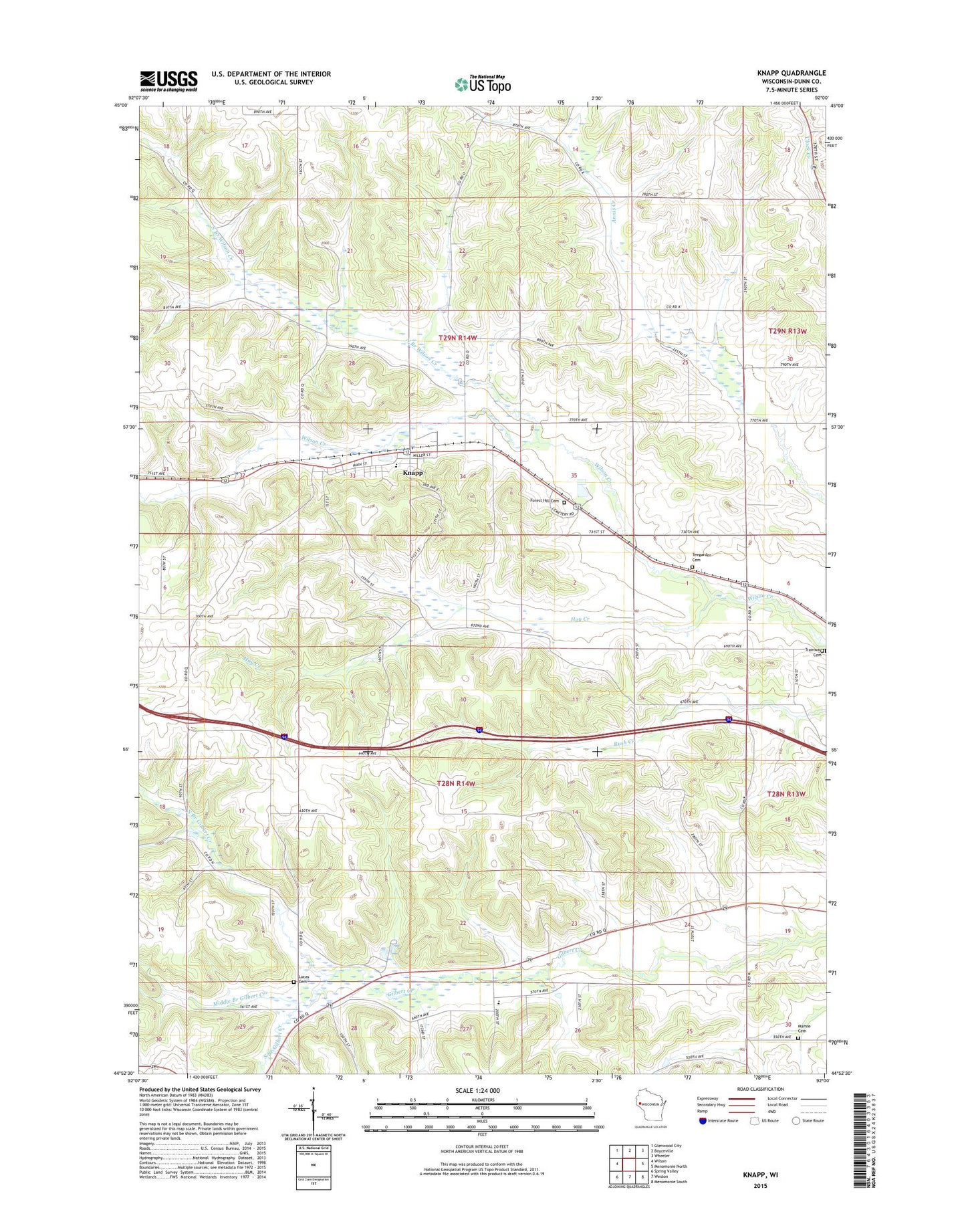
2022 topographic map quadrangle Knapp in the state of Wisconsin. Scale: 1:24000. Based on the newly updated USGS 7.5' US Topo map series, this map is in the following counties: Dunn. The map contains contour data, water features, and other items you are used to seeing on USGS maps, but also has updated roads and other features. This is the next generation of topographic maps. Printed on high-quality waterproof paper with UV fade-resistant inks.
Quads adjacent to this one:
West: Wilson
Northwest: Glenwood City
North: Boyceville
Northeast: Wheeler
East: Menomonie North
Southeast: Menomonie South
South: Weston
Southwest: Spring Valley
This map covers the same area as the classic USGS quad with code o44092h1.
Contains the following named places: Forest Hill Cemetery, Hay Creek, Knapp, Knapp Elementary School, Knapp Post Office, Lierman School, Lucas Cemetery, Lucas Charter School, Mamre Cemetery, Maple School, Meadow Brook School, Middle Branch Gilbert Creek, Miller Hill School, North Branch Gilbert Creek, North Branch Wilson Creek, Peck School, South Branch Gilbert Creek, Teegarden Cemetery, Town of Lucas, Town of Stanton, Tramway Cemetery, Village of Knapp, ZIP Code: 54749