MyTopo
Whitelaw Wisconsin US Topo Map
Couldn't load pickup availability
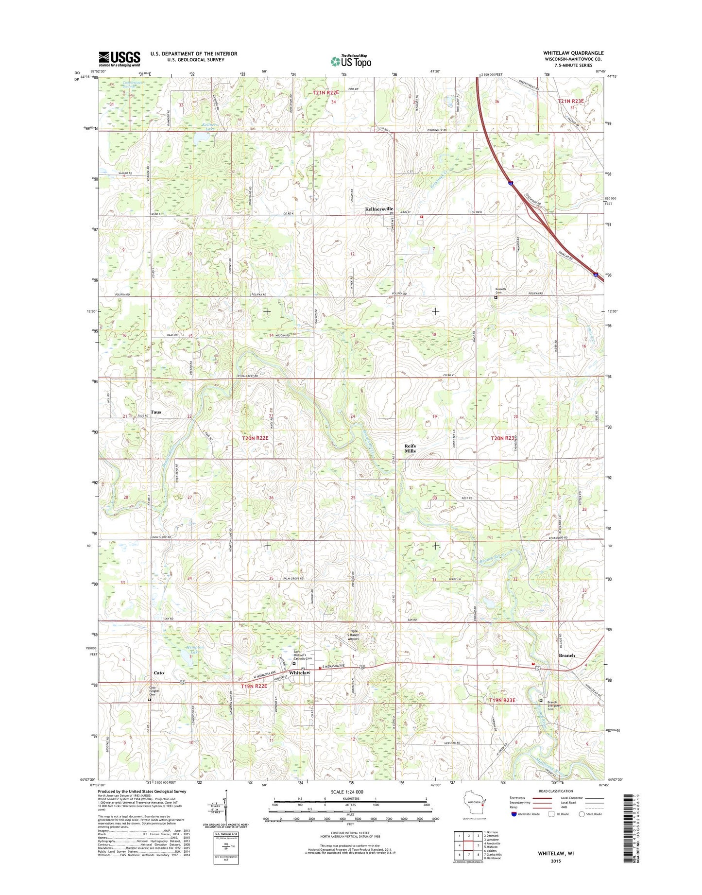
2022 topographic map quadrangle Whitelaw in the state of Wisconsin. Scale: 1:24000. Based on the newly updated USGS 7.5' US Topo map series, this map is in the following counties: Manitowoc. The map contains contour data, water features, and other items you are used to seeing on USGS maps, but also has updated roads and other features. This is the next generation of topographic maps. Printed on high-quality waterproof paper with UV fade-resistant inks.
Quads adjacent to this one:
West: Reedsville
Northwest: Morrison
North: Denmark
Northeast: Larrabee
East: Mishicot
Southeast: Manitowoc
South: Clarks Mills
Southwest: Valders
This map covers the same area as the classic USGS quad with code o44087b7.
Contains the following named places: Alimar Farms, Branch, Branch Evergreen Cemetery, Branch Fire and Rescue, Branch Firefighters Park, Branch River, Branch River Country Club, Braun Earth Acres, Brockville School, Cato, Cato Heights Cemetery, Cedar Ridge Farm, Ebert Dairy Farm, Edgewood Game Farm, Eisland Farms, Elm View School, French Creek Farms, Hempton Lake, Herrmann Farms, Highland School, Kayville Mobile Home Park, Kellners Lake, Kellnersville, Kellnersville Post Office, Kellnersville School, Kellnersville Volunteer Fire Department, Kieselhorst Farms, Kossuth National Cemetery, Lannbrecht Little Brook Farms, Maple Crest Sanitarium, Palm Grove School, Polifka Corners, Reifs Mills, Ridgeview Landfill, Rosik Farm, Saint Augustine Church, Saint Augustines Catholic Church, Saint Michael Grade School, Saint Michael's Catholic Cemetery, Saint Michaels Catholic Church, Sunny Slope School, Taus, Town of Franklin, Triple S Ranch Airport, Village of Kellnersville, Village of Whitelaw, Waack Family Farms, Whitelaw, Whitelaw Post Office, Whitelaw School, Whitelaw Volunteer Fire Department, Whitelaw Wastewater Treatment Plant, Willow Creek Farms, Wolfgang Dairy, ZIP Code: 54247