MyTopo
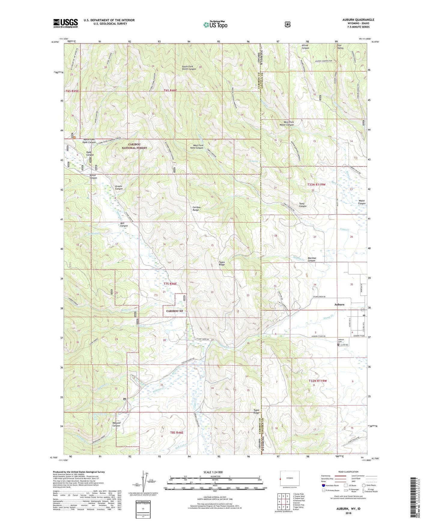
Auburn Wyoming US Topo Map
Couldn't load pickup availability
Also explore the Auburn Forest Service Topo of this same quad for updated USFS data
2021 topographic map quadrangle Auburn in the states of Idaho, Wyoming. Scale: 1:24000. Based on the newly updated USGS 7.5' US Topo map series, this map is in the following counties: Lincoln, Caribou. The map contains contour data, water features, and other items you are used to seeing on USGS maps, but also has updated roads and other features. This is the next generation of topographic maps. Printed on high-quality waterproof paper with UV fade-resistant inks.
Quads adjacent to this one:
West: Diamond Flat
Northwest: Stump Peak
North: Thayne West
Northeast: Thayne East
East: Grover
Southeast: Afton
South: Sage Valley
Southwest: Stewart Flat
This map covers the same area as the classic USGS quad with code o42111g1.
Contains the following named places: Auburn, Auburn Cemetery, Auburn Census Designated Place, Auburn Post Office, Cow Creek, Emigrant Trail, Graehl Canyon, Horse Creek, Hyde Canyon, Martha Creek, Marthas Canyon, Mill Canyon, Miller Ranch, North Fork Hyde Canyon, O E Spring, Oe Spring, Petersons Ranch, Salt Lick Creek, Sheep Creek, Spring Creek, Stadium Creek, State Line Ditch, Stump Creek Guard Station, The Falls, The Falls Creek, Toms Canyon, Tygee Creek, Water Canyon, Water Creek, Webster Canyon, Webster Creek, West Fork Toms Canyon, West Fork Water Canyon, White Canyon