MyTopo
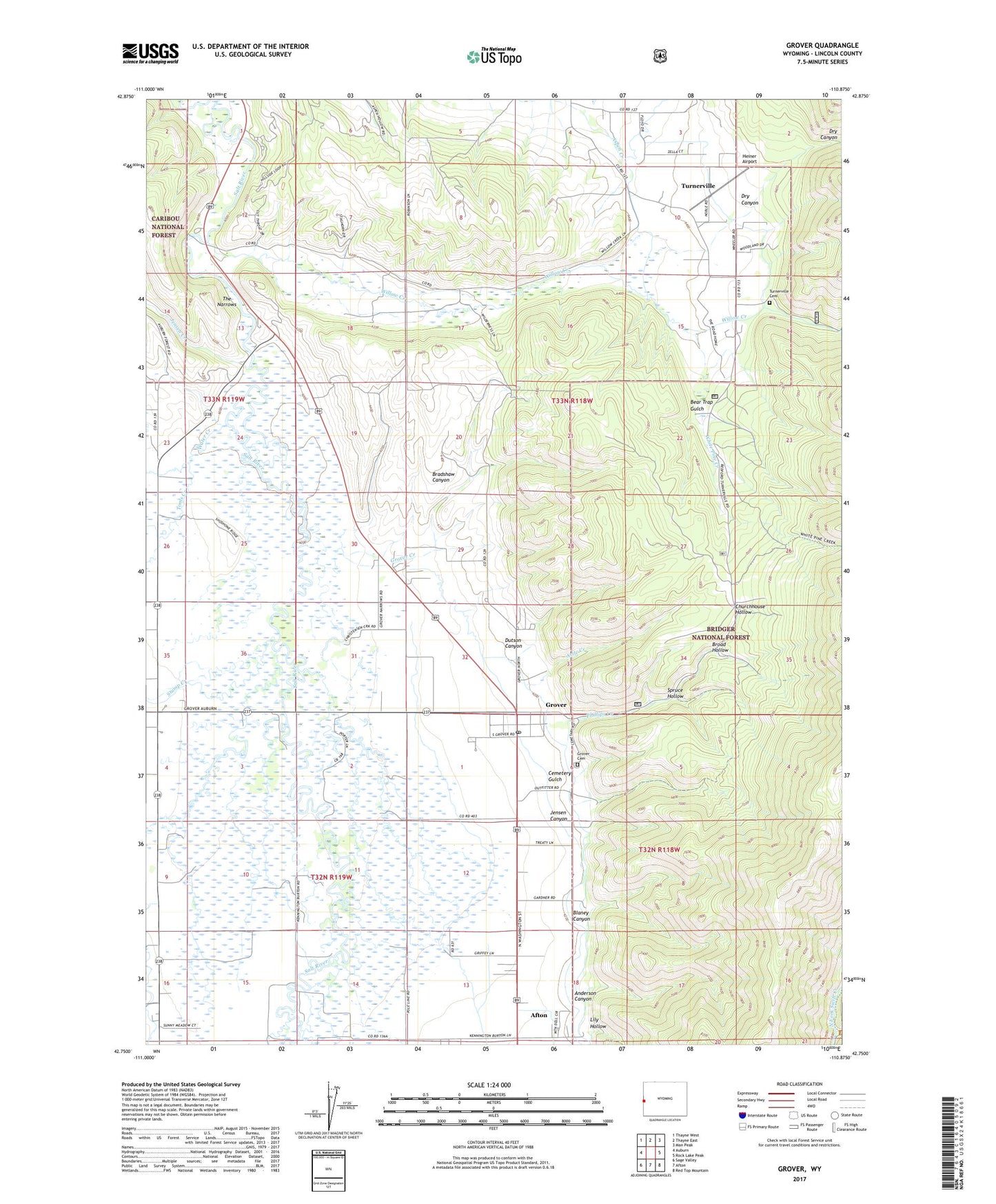
Grover Wyoming US Topo Map
Couldn't load pickup availability
Also explore the Grover Forest Service Topo of this same quad for updated USFS data
2021 topographic map quadrangle Grover in the state of Wyoming. Scale: 1:24000. Based on the newly updated USGS 7.5' US Topo map series, this map is in the following counties: Lincoln. The map contains contour data, water features, and other items you are used to seeing on USGS maps, but also has updated roads and other features. This is the next generation of topographic maps. Printed on high-quality waterproof paper with UV fade-resistant inks.
Quads adjacent to this one:
West: Auburn
Northwest: Thayne West
North: Thayne East
Northeast: Man Peak
East: Rock Lake Peak
Southeast: Red Top Mountain
South: Afton
Southwest: Sage Valley
This map covers the same area as the classic USGS quad with code o42110g8.
Contains the following named places: Anderson Canyon, Astle Creek, Bear Trap Gulch, Blaney Canyon, Bradshaw Canyon, Broad Hollow, Cemetery Gulch, Churchhouse Hollow, Crow Creek, Dry Canyon, Dutson Canyon, Grover, Grover Cemetery, Grover Census Designated Place, Grover Creek, Grover Park, Grover Post Office, Heiner Airport, Jensen Canyon, Jensen Creek, KRSV-FM (Afton), Leefe Mine, Lily Hollow, North Fork Swift Creek, Phillips Creek, Spring Creek, Spruce Hollow, Stump Creek, The Narrows, Toms Creek, Turnerville, Turnerville Cemetery, Turnerville Census Designated Place, Turnerville Community, White Pine Creek, Willow Creek, ZIP Code: 83122