MyTopo
Gomer Draw Montana US Topo Map
Couldn't load pickup availability
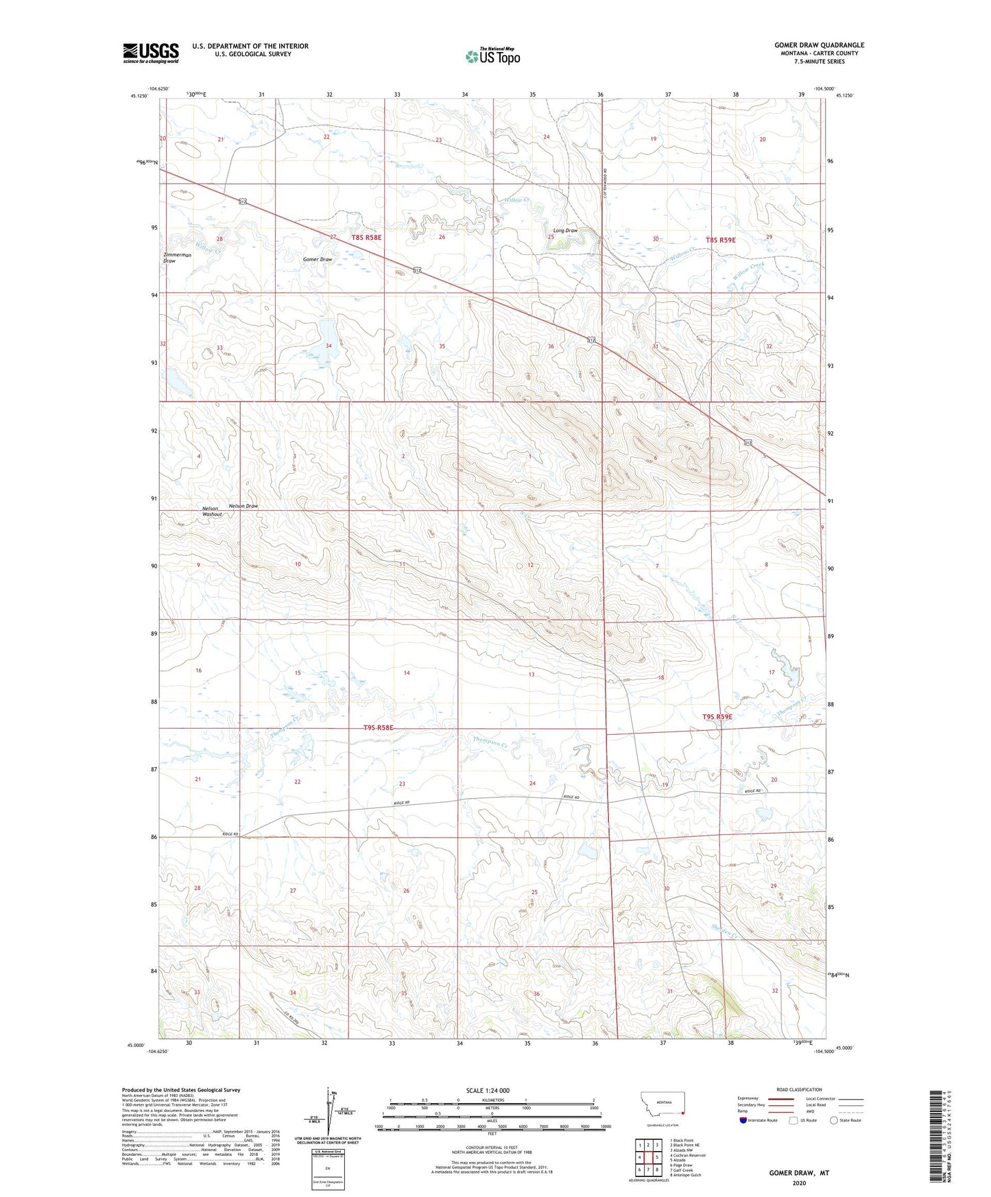
2024 topographic map quadrangle Gomer Draw in the state of Montana. Scale: 1:24000. Based on the newly updated USGS 7.5' US Topo map series, this map is in the following counties: Carter. The map contains contour data, water features, and other items you are used to seeing on USGS maps, but also has updated roads and other features. This is the next generation of topographic maps. Printed on high-quality waterproof paper with UV fade-resistant inks.
Quads adjacent to this one:
West: Cochran Reservoir
Northwest: Black Point
North: Black Point NE
Northeast: Alzada NW
East: Alzada
Southeast: Antelope Gulch
South: Gaff Creek
Southwest: Page Draw
This map covers the same area as the classic USGS quad with code o45104a5.
Contains the following named places: A58-36-12 Mine, A58-36-13 Mine, A58-36-15 Mine, A58-36-2 Mine, A58-36-9 Mine, B58-26-1 Mine, B58-26-4 Mine, B58-27-1 Mine, B58-33-2 Mine, B58-34-1, B58-34-4 Mine, B58-34-6 Mine, Gomer Draw, K and L McDowell Number 3 Dam, Larry Pilster Number 2 Dam, Long Draw, North Creek, Prairiedog Dam, Willow Creek, Wyotana Ranch Number 5 Dam, X58-27-4 Mine, X58-33-3 Mine, Zimmerman Draw