MyTopo
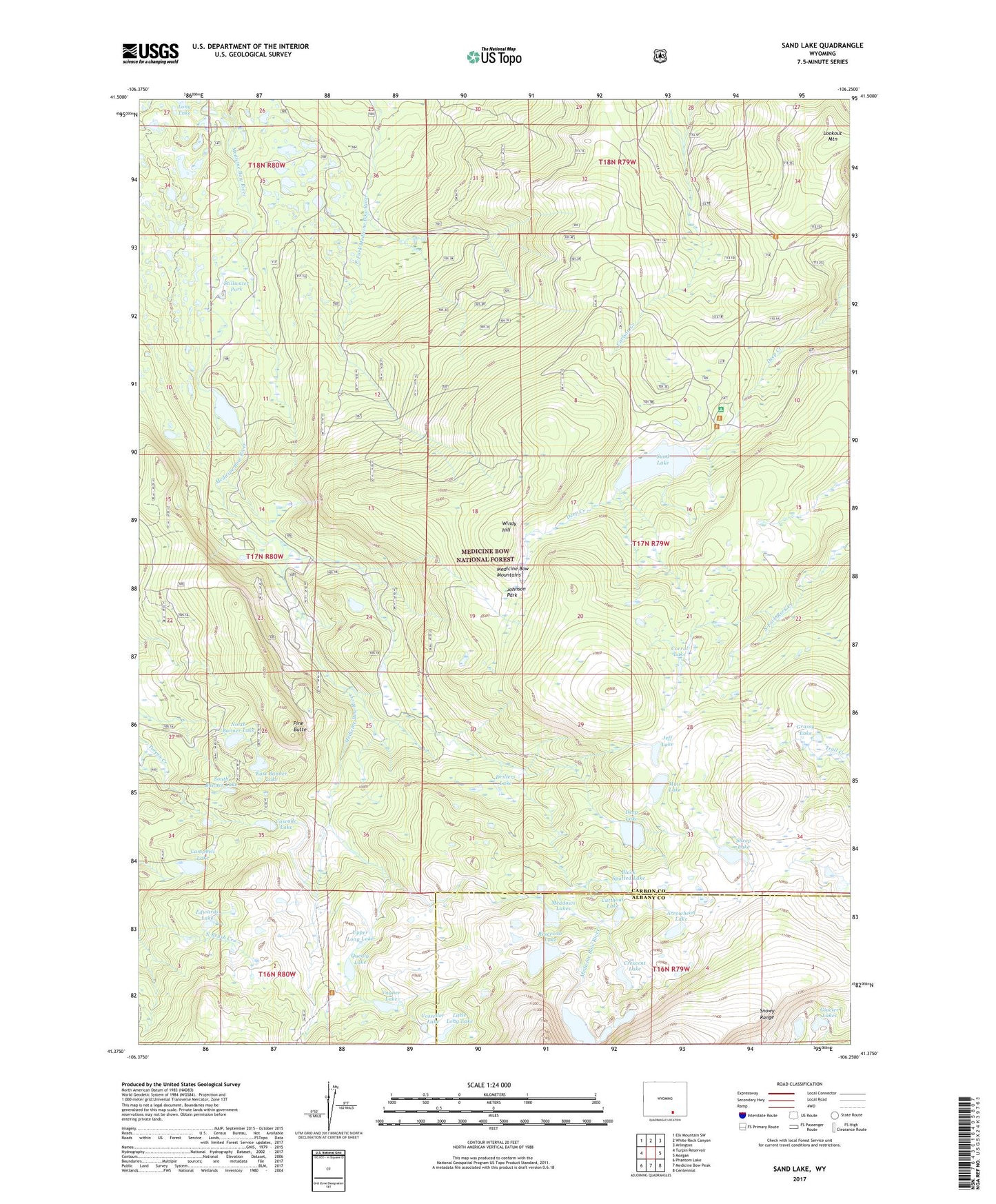
Sand Lake Wyoming US Topo Map
Couldn't load pickup availability
Also explore the Sand Lake Forest Service Topo of this same quad for updated USFS data
2021 topographic map quadrangle Sand Lake in the state of Wyoming. Scale: 1:24000. Based on the newly updated USGS 7.5' US Topo map series, this map is in the following counties: Carbon, Albany. The map contains contour data, water features, and other items you are used to seeing on USGS maps, but also has updated roads and other features. This is the next generation of topographic maps. Printed on high-quality waterproof paper with UV fade-resistant inks.
Quads adjacent to this one:
West: Turpin Reservoir
Northwest: Elk Mountain SW
North: White Rock Canyon
Northeast: Arlington
East: Morgan
Southeast: Centennial
South: Medicine Bow Peak
Southwest: Phantom Lake
This map covers the same area as the classic USGS quad with code o41106d3.
Contains the following named places: Arrowhead Lake, Black Spotted Lake, Bow River Observation Site, Bow River Overlook, Campbell Lake, Carlson Park, Carlson Park Guard Station, Cascade Lake, Corpening Dam, Corpening Reservoir, Corral Lake, Crescent Lake, Cutthoat Lake, Deep Creek Campground, Deep Lake, Drillers Lake, East Banner Lake, Edwards Lake, Glacier Lakes, Golden Crown Mining Syndicate Mine, Grassy Lake, Jeff Lake, Johnson Park, Little Long Lake, Lookout Mountain, Meadows Lakes, Mutt Lake, North Banner Lake, North Gap Lake, Pine Butte, Quealy Lake, Reservoir Lake, Sand Lake, Sand Lake Lodge, Sheep Lake, Shelf Lakes, Snowy Range, South Banner Lake, Stillwater Park, Upper Long Lake, Vagner Lake, Vosseller Lake, Waterloo Prospect, Wheatland Reservoir Dam, Windy Hill