MyTopo
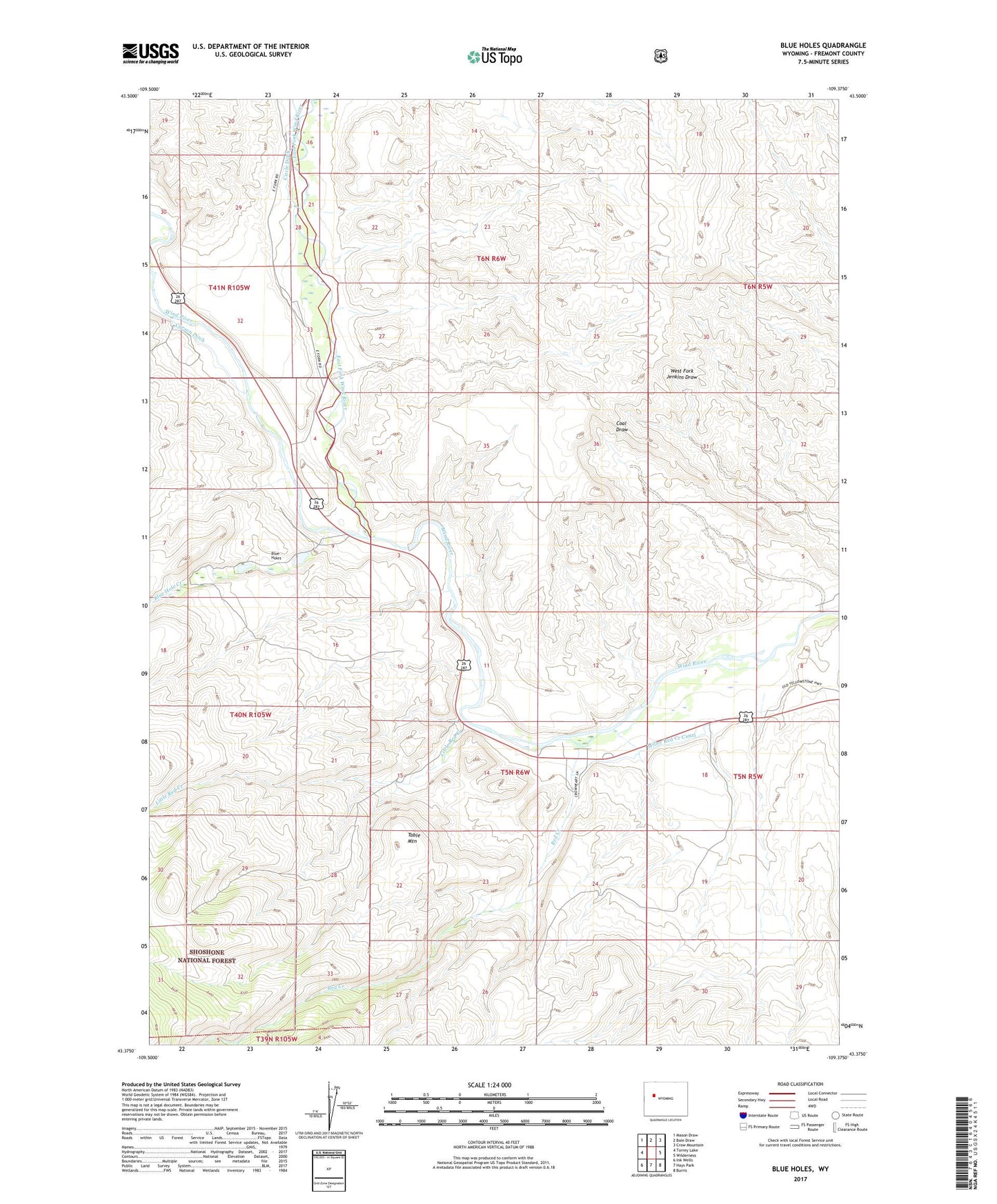
Blue Holes Wyoming US Topo Map
Couldn't load pickup availability
Also explore the Blue Holes Forest Service Topo of this same quad for updated USFS data
2021 topographic map quadrangle Blue Holes in the state of Wyoming. Scale: 1:24000. Based on the newly updated USGS 7.5' US Topo map series, this map is in the following counties: Fremont. The map contains contour data, water features, and other items you are used to seeing on USGS maps, but also has updated roads and other features. This is the next generation of topographic maps. Printed on high-quality waterproof paper with UV fade-resistant inks.
Quads adjacent to this one:
West: Torrey Lake
Northwest: Mason Draw
North: Bain Draw
Northeast: Crow Mountain
East: Wilderness
Southeast: Burris
South: Hays Park
Southwest: Ink Wells
This map covers the same area as the classic USGS quad with code o43109d4.
Contains the following named places: Blue Hole Creek, Blue Holes, East Fork Wind River, Little Red Creek, Miller Red Creek Canal, Red Creek, Red Creek Mine, State Game and Fish Checking Station, Table Mountain