MyTopo
Wapiti Wyoming US Topo Map
Couldn't load pickup availability
Also explore the Wapiti Forest Service Topo of this same quad for updated USFS data
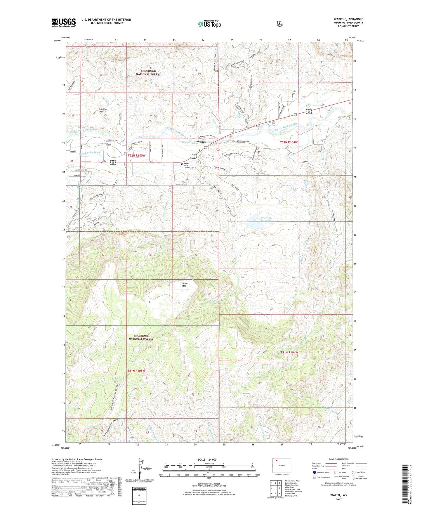
2021 topographic map quadrangle Wapiti in the state of Wyoming. Scale: 1:24000. Based on the newly updated USGS 7.5' US Topo map series, this map is in the following counties: Park. The map contains contour data, water features, and other items you are used to seeing on USGS maps, but also has updated roads and other features. This is the next generation of topographic maps. Printed on high-quality waterproof paper with UV fade-resistant inks.
Quads adjacent to this one:
West: Flag Peak
Northwest: Dead Indian Peak
North: Jim Mountain
Northeast: Logan Mountain
East: Castle Rock Creek
Southeast: Belknap Creek
South: Twin Creek
Southwest: Ptarmigan Mountain
This map covers the same area as the classic USGS quad with code o44109d4.
Contains the following named places: Bi Ho Ba Girl Scout Camp, Bradford Ranch, Breteche Creek, Chinese Wall, Dahlem Ranch, Diamond Bar Cow Camp, Dunn Creek, Flying L Skytel Airport, Frost Dam, Frost Reservoir, Green Creek, Jim Creek, North Fork Valley Ditch, Park County Fire Protection District 2 Station 4 Wapiti Valley, Rand Creek, River Rest Resort, Slack Creek, Stonebridge Dam, Stonebridge Reservoir, Table Mountain, Table Mountain Trail, Wall Creek, Wapiti, Wapiti Elementary School, Wapiti Valley Church Cemetery, Whit Creek