MyTopo
Big Horn Wyoming US Topo Map
Couldn't load pickup availability
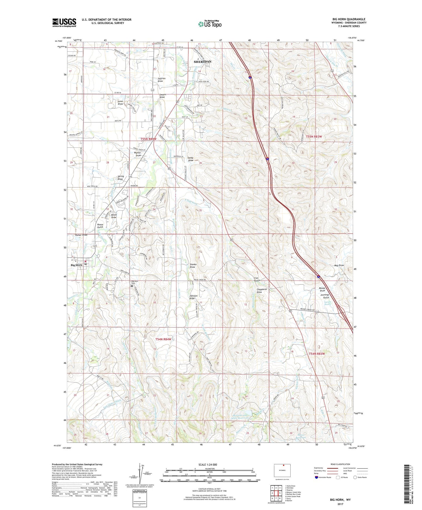
2021 topographic map quadrangle Big Horn in the state of Wyoming. Scale: 1:24000. Based on the newly updated USGS 7.5' US Topo map series, this map is in the following counties: Sheridan. The map contains contour data, water features, and other items you are used to seeing on USGS maps, but also has updated roads and other features. This is the next generation of topographic maps. Printed on high-quality waterproof paper with UV fade-resistant inks.
Quads adjacent to this one:
West: Beaver Creek Hills
Northwest: Hultz Draw
North: Sheridan
Northeast: Wyarno
East: Buffalo Run Creek
Southeast: Banner
South: Story
Southwest: Little Goose Peak
Contains the following named places: Allen Dam, Allen Reservoir, Big Horn, Big Horn Census Designated Place, Big Horn High School, Big Horn Middle School, Big Horn Post Office, Big Horn Rest Home, Big Horn School, Big Horn Volunteer Fire Department, Chapparal Draw, Coyote Creek, Denio Draw, Duncan Dam, Duncan Reservoir, East Fork Kruse Creek, East Fork Sackett Creek, East Side Ditch, Gerdel Ditch, Hanes Fork, Hanes Reservoir, Hanna Creek, Iron Gulch, Jackson Creek, Jeffries Draw, Jennings Gulch, Johnson Draw, Jones Draw, Kemp Creek, Kruse Creek, Kusel Creek, Larison Swale, Last Chance Ditch, Lee Creek, May Draw, McCormick Creek, Meade Creek Ranch, Meade Creek School, Menardi and White Dam, Menardi and White Reservoir, Moose Draw, Mount Hope Cemetery, Parken Fork, Parker Draw, Powder Horn, Powder Horn Census Designated Place, Reese Gulch, Rifle Creek, Sackett Creek, Sandy Draw, Spring Draw, Stanko Draw, Swaim Draw, Woodland Park Elementary School, Wymer Draw