MyTopo
Hultz Draw Wyoming US Topo Map
Couldn't load pickup availability
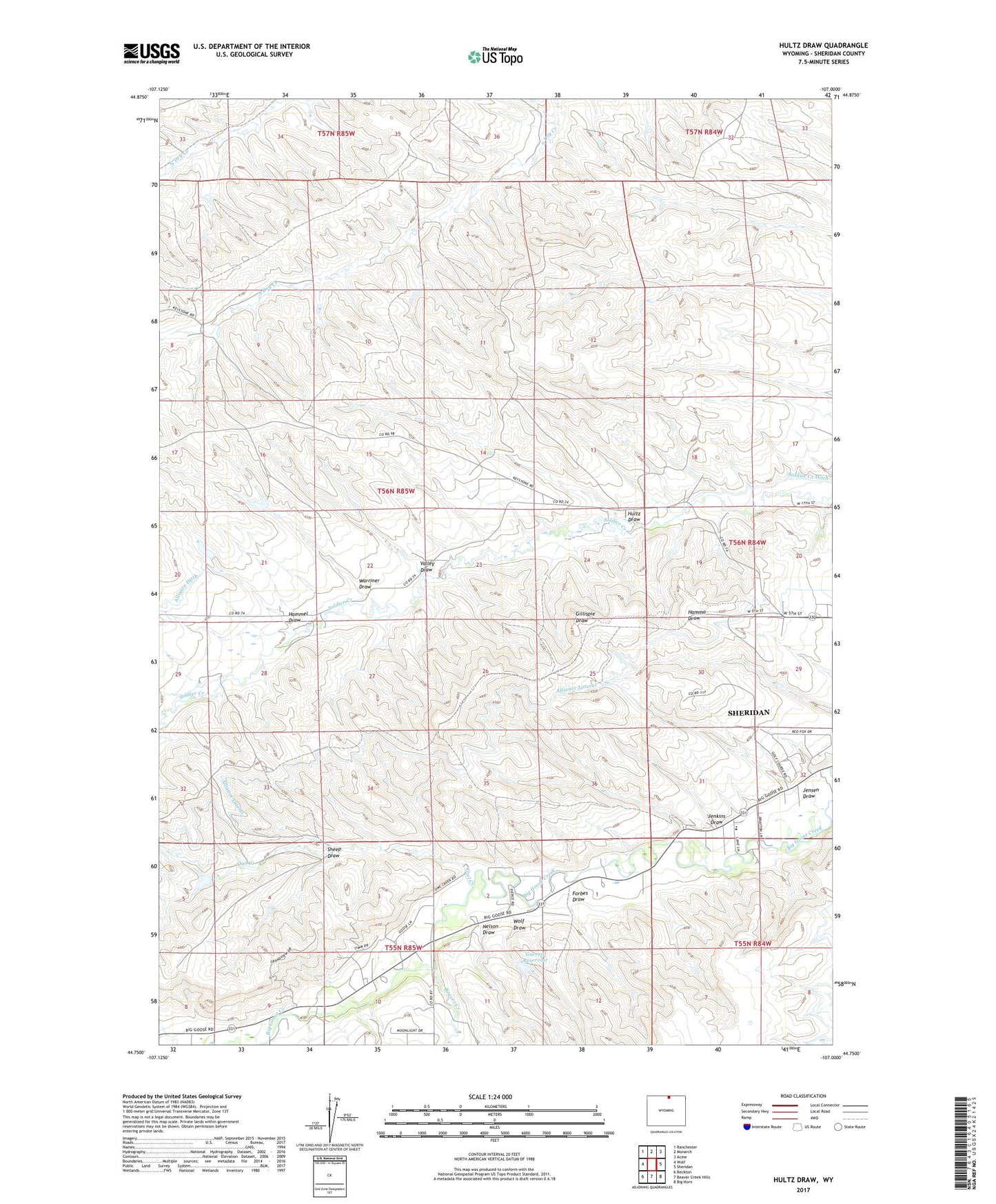
2021 topographic map quadrangle Hultz Draw in the state of Wyoming. Scale: 1:24000. Based on the newly updated USGS 7.5' US Topo map series, this map is in the following counties: Sheridan. The map contains contour data, water features, and other items you are used to seeing on USGS maps, but also has updated roads and other features. This is the next generation of topographic maps. Printed on high-quality waterproof paper with UV fade-resistant inks.
Quads adjacent to this one:
West: Wolf
Northwest: Ranchester
North: Monarch
Northeast: Acme
East: Sheridan
Southeast: Big Horn
South: Beaver Creek Hills
Southwest: Beckton
This map covers the same area as the classic USGS quad with code o44107g1.
Contains the following named places: Alliance Lateral, Baker Creek, Beaver Creek, Beaver Creek Mine, Big Goose School, Dygert Pit, Forbes Draw, Fryberger Dam, Fryberger Reservoir, Garrett Dam, Garrett Reservoir, Gregg Draw, Hammel Draw, Hultz Draw, Jenkins Draw, Jensen Draw, Moose Mine, Nelson Draw, Owl Creek, Owl Creek Mine, Sheep Draw, Valley Draw, Warriner Draw, Warriner Number 2 Dam, Warriner Reservoir, Wolf Draw