MyTopo
Sheridan Wyoming US Topo Map
Couldn't load pickup availability
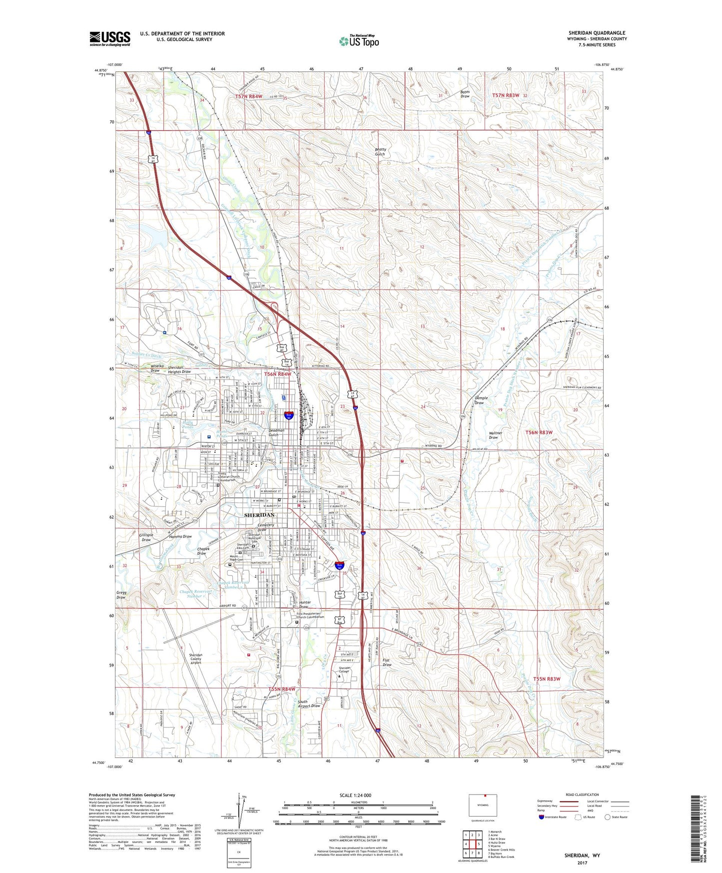
2021 topographic map quadrangle Sheridan in the state of Wyoming. Scale: 1:24000. Based on the newly updated USGS 7.5' US Topo map series, this map is in the following counties: Sheridan. The map contains contour data, water features, and other items you are used to seeing on USGS maps, but also has updated roads and other features. This is the next generation of topographic maps. Printed on high-quality waterproof paper with UV fade-resistant inks.
Quads adjacent to this one:
West: Hultz Draw
Northwest: Monarch
North: Acme
Northeast: Bar N Draw
East: Wyarno
Southeast: Buffalo Run Creek
South: Big Horn
Southwest: Beaver Creek Hills
This map covers the same area as the classic USGS quad with code o44106g8.
Contains the following named places: Big Goose Creek, Bighorn National Forest Tongue Ranger District Fire Engine Crew, Burn Cleuch Ditch, Cemetery Draw, Central Junior High School, Chapek Draw, Chapek Reservoir Number 1, Chapek Reservoir Number 2, City of Sheridan, Deadman Gulch, Demple Draw, Dietz Mine, Dietz Number Four Mine, Dietz Number Six Mine, Dietz Number Three Mine, Dietz Number Two Mine, Dry Creek, First Presbyterian Church Columbarium, Flat Draw, Gillispie Draw, Grinnell Livestock Company Ditch, Hamma Draw, Henry A Coffeen Elementary School, Highland Park Elementary School, Holly Ponds, Hume Ponds, Hunter Draw, Kendrick Park, KLWD-FM (Sheridan), KRoe-AM (Sheridan), KRoe-FM (Sheridan), KWYO-AM (Sheridan), Linden School, Little Goose Creek, Martin Prospect Mine, Meadowlark Elementary School, Mount Hope Cemetery, Ninemile Ditch, Prairie Dog Ditch Number 12, Rocky Mountain Ambulance, Saint Peters Episcopal Church Columbarium, Sheridan, Sheridan Area Rural Fire Protection District, Sheridan College, Sheridan County, Sheridan County Airport, Sheridan County Sheriff's Office, Sheridan Elks Cemetery, Sheridan Fire and Rescue Station, Sheridan Heights Dam, Sheridan Heights Draw, Sheridan Heights Reservoir, Sheridan Inn National Historical Landmark, Sheridan Memorial Hospital, Sheridan Municipal Cemetery, Sheridan Police Department, Sheridan Post Office, Sheridan Veterans Affairs Medical Center, Smith Mine, Soldier Creek, Soldier Creek Ditch, South Airport Draw, Taylor School, Thorne Ridge Stadium, Trinity Lutheran Church Columbarium, Wakeley, Wakeley School, Weltner Draw, Windy Draw Dam, Windy Draw Reservoir, Wiselka Draw, Wyoming Highway Patrol District 4 Division C