MyTopo
Big Sandy Opening Wyoming US Topo Map
Couldn't load pickup availability
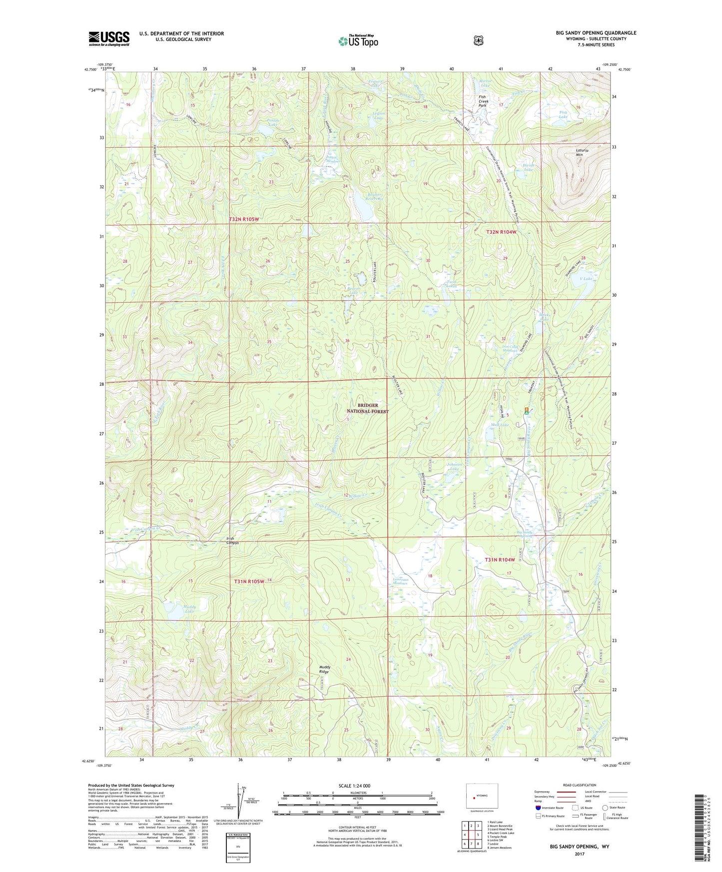
2021 topographic map quadrangle Big Sandy Opening in the state of Wyoming. Scale: 1:24000. Based on the newly updated USGS 7.5' US Topo map series, this map is in the following counties: Sublette. The map contains contour data, water features, and other items you are used to seeing on USGS maps, but also has updated roads and other features. This is the next generation of topographic maps. Printed on high-quality waterproof paper with UV fade-resistant inks.
Quads adjacent to this one:
West: Pocket Creek Lake
Northwest: Raid Lake
North: Mount Bonneville
Northeast: Lizard Head Peak
East: Temple Peak
Southeast: Jensen Meadows
South: Leckie
Southwest: Leckie SW
Contains the following named places: Beaver Creek, Beaver Lake, Big Sandy Campground, Big Sandy Lodge, Big Sandy Opening, Boulter Dam, Boulter Lake, Boulter Reservoir, Boundary Creek, Boundary Creek Trail, Dads Creek, Diamond Lake Trail, Fish Creek, Fish Creek Park, Fish Lake, Francis Lake, Francis Lake Tail, Fremout Driveway, Highline Trail, Irish Canyon, Iron Creek, Iron Creek Meadows, Johnson Lake, Lamreaux Meadows, Legion Lake, Meeks Lake, Mirror Lake, Mud Lake, Muddy Lake, Poston Lake, Poston Meadows, South Temple Creek, Temple Creek Summer Home Area, Twin Lakes, V Lake, Wheeler Ranch Trail, Willow Creek