MyTopo
Raid Lake Wyoming US Topo Map
Couldn't load pickup availability
Also explore the Raid Lake Forest Service Topo of this same quad for updated USFS data
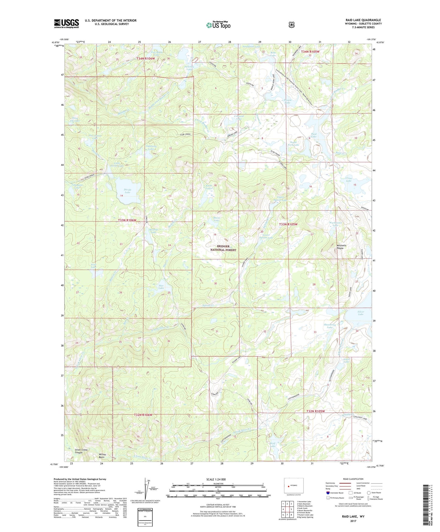
2021 topographic map quadrangle Raid Lake in the state of Wyoming. Scale: 1:24000. Based on the newly updated USGS 7.5' US Topo map series, this map is in the following counties: Sublette. The map contains contour data, water features, and other items you are used to seeing on USGS maps, but also has updated roads and other features. This is the next generation of topographic maps. Printed on high-quality waterproof paper with UV fade-resistant inks.
Quads adjacent to this one:
West: Scab Creek
Northwest: Horseshoe Lake
North: Halls Mountain
Northeast: Roberts Mountain
East: Mount Bonneville
Southeast: Big Sandy Opening
South: Pocket Creek Lake
Southwest: Fremont Butte
This map covers the same area as the classic USGS quad with code o42109g4.
Contains the following named places: Bobs Lake, Chilcoot Trail, Cottonwood Trail, Crescent Lake, Cross Lake, Divide Dam, Divide Lake, Divide Reservoir, Dream Creek, Dream Lake, Dream Lake Trail, Full Moon Lake, Halls Creek, Jessie Lake, Junction Lake, Knob Lakes, Lightning Lakes, Little Divide Lake, Lower Sylvan Lake, Lowline Trail, Middle Fork Boulder Creek, Mitchells Nipple, Monroe Creek, Monroe Lake, Moose Lake, North Fork Silver Creek, Pine Island Lake, Raid Creek, Raid Lake, Sage Basin Trail, Scab Creek Trail, Scab Lake, Scab Sage Trail, Sheep Creek, Shoestring Lake, Silver Lake, Silver Lake Dam, Silver Lake Trail, South Fork Boulder Creek, South Fork Lake, South Fork Silver Creek, Star Creek, Star Lake, Sylvan Creek, Sylvan Lake Trail, Three Elk Lake, Toboggan Lake, Upper Silver Lakes, Upper Sylvan Lake, Warbonnet Lake, Whisky Creek, Willow Basin, Wolf Lake