MyTopo
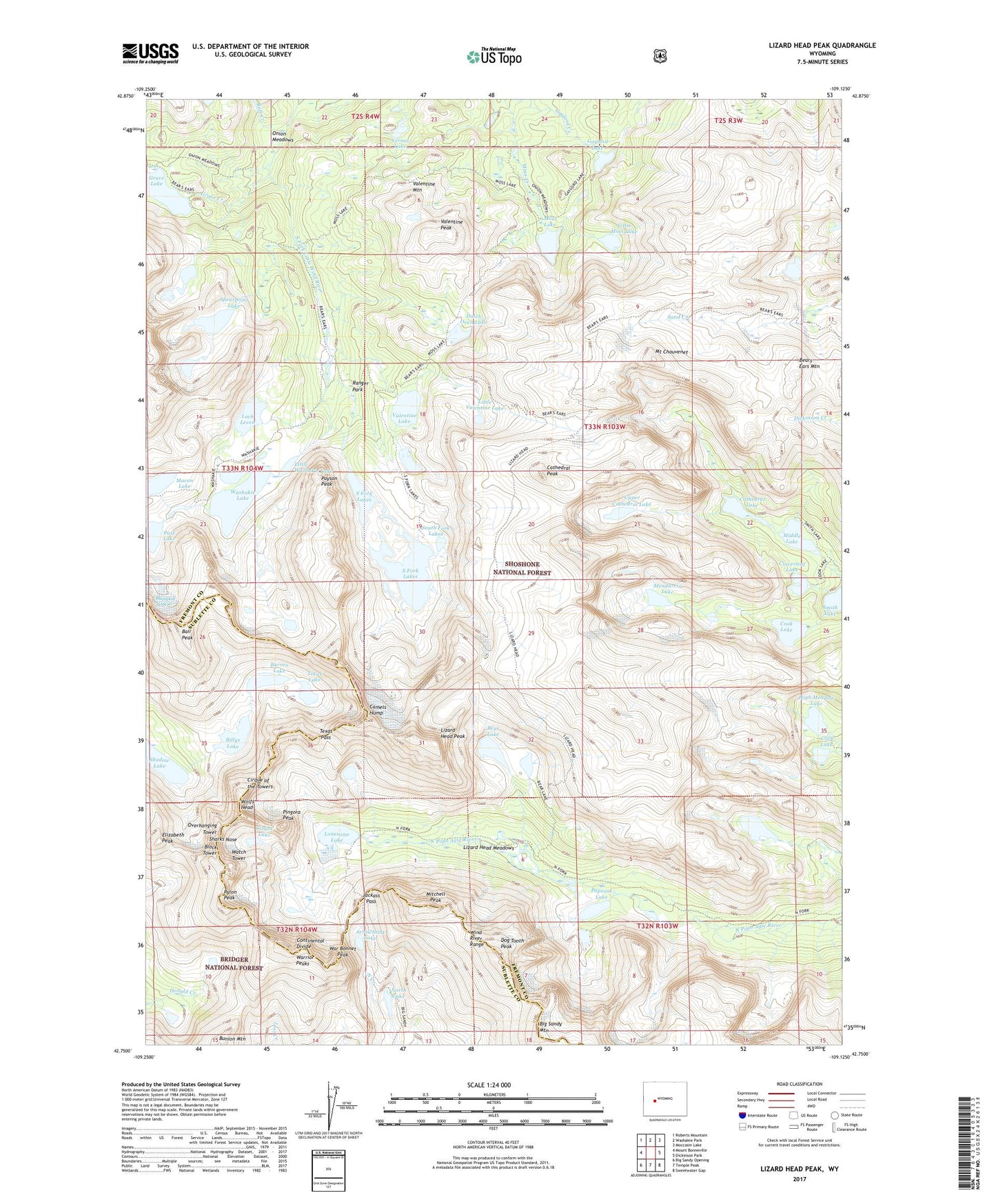
Lizard Head Peak Wyoming US Topo Map
Couldn't load pickup availability
Also explore the Lizard Head Peak Forest Service Topo of this same quad for updated USFS data
2021 topographic map quadrangle Lizard Head Peak in the state of Wyoming. Scale: 1:24000. Based on the newly updated USGS 7.5' US Topo map series, this map is in the following counties: Fremont, Sublette. The map contains contour data, water features, and other items you are used to seeing on USGS maps, but also has updated roads and other features. This is the next generation of topographic maps. Printed on high-quality waterproof paper with UV fade-resistant inks.
Quads adjacent to this one:
West: Mount Bonneville
Northwest: Roberts Mountain
North: Washakie Park
Northeast: Moccasin Lake
East: Dickinson Park
Southeast: Sweetwater Gap
South: Temple Peak
Southwest: Big Sandy Opening
This map covers the same area as the classic USGS quad with code o42109g2.
Contains the following named places: Arrowhead Lake, Bair Peak, Barren Lake, Bear Lake, Bears Ears Mountain, Big Sandy Mountain, Billys Lake, Block Tower, Camels Hump, Cathedral Lake, Cathedral Peak, Cirque Lake, Cirque of the Towers, Cliff Lake, Cloverleaf Lake, Cook Lake, Dog Tooth Peak, Dutch Oven Lake, Elizabeth Peak, Gaylord Lake, Gaylord Lake Trail, Grave Creek, High Meadow Lake, Jackass Pass, Little Moss Lake, Little Valentine Lake, Little Washakie Lake, Lizard Head Meadows, Lizard Head Peak, Lizard Head Trail, Loch Leven, Lonesome Lake, Macon Lake, Mendarrin Lake, Middle Lake, Mitchell Peak, Moss Lake, Moss Lake Trail, Mount Chauvenet, North Lake, Onion Meadows, Overhanging Tower, Papoose Lake, Pass Lake, Payson Peak, Pingora Peak, Pylon Peak, Raft Creek, Ranger Park, Shadow Lake, Sharks Nose, South Fork Lakes, Spearpoint Lake, Texas Lake, Texas Pass, Upper Cathedral Lake, Valentine Lake, Valentine Mountain, Valentine Peak, Vernal Lake, War Bonnet Peak, Warrior Peaks, Washakie Glacier, Washakie Lake, Washakie Trail, Watch Tower, Wolfs Head