MyTopo
Cabin Creek SE Wyoming US Topo Map
Couldn't load pickup availability
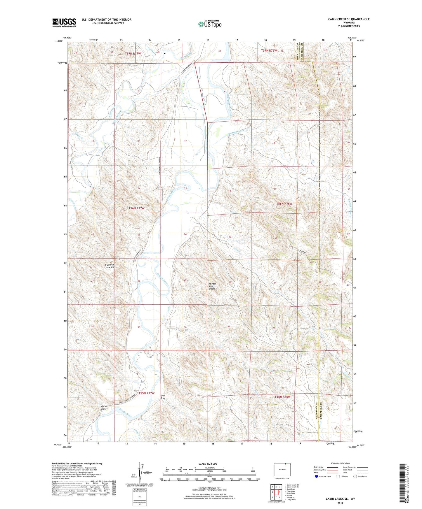
2023 topographic map quadrangle Cabin Creek SE in the state of Wyoming. Scale: 1:24000. Based on the newly updated USGS 7.5' US Topo map series, this map is in the following counties: Sheridan, Campbell. The map contains contour data, water features, and other items you are used to seeing on USGS maps, but also has updated roads and other features. This is the next generation of topographic maps. Printed on high-quality waterproof paper with UV fade-resistant inks.
Quads adjacent to this one:
West: Fawn Draw
Northwest: Cabin Creek NW
North: Cabin Creek NE
Northeast: Black Draw
East: Kline Draw
Southeast: Larey Draw
South: Arvada NE
Southwest: Arvada
This map covers the same area as the classic USGS quad with code o44106g1.
Contains the following named places: Cabin Creek, Cross H Creek, Ivy Creek, Joe Creek, K Ranch, Kendrick Canal, L Quarter Circle Hills, Lynn Draw, Powder River Breaks, Spotted Horse Creek, Squaw Creek, Waisner Draw