MyTopo
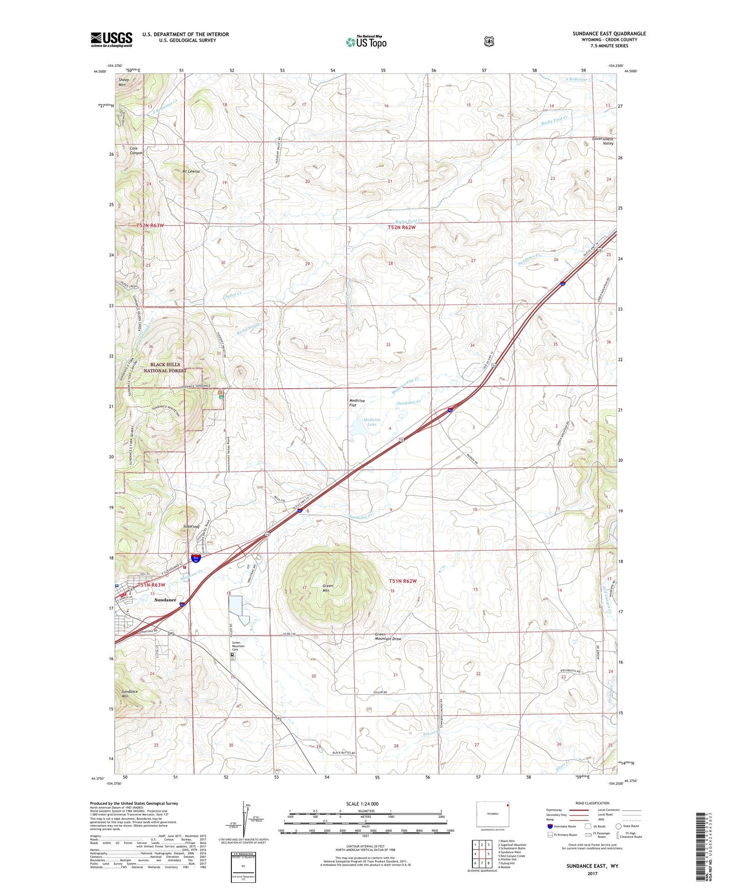
Sundance East Wyoming US Topo Map
Couldn't load pickup availability
Also explore the Sundance East Forest Service Topo of this same quad for updated USFS data
2021 topographic map quadrangle Sundance East in the state of Wyoming. Scale: 1:24000. Based on the newly updated USGS 7.5' US Topo map series, this map is in the following counties: Crook. The map contains contour data, water features, and other items you are used to seeing on USGS maps, but also has updated roads and other features. This is the next generation of topographic maps. Printed on high-quality waterproof paper with UV fade-resistant inks.
Quads adjacent to this one:
West: Sundance West
Northwest: Black Hills
North: Sugarloaf Mountain
Northeast: Schoolmarm Butte
East: Red Canyon Creek
Southeast: Moskee
South: Duling Hill
Southwest: Pfeiffer Hill
This map covers the same area as the classic USGS quad with code o44104d3.
Contains the following named places: Bear Lodge District Mine, Black Hills National Forest Bearlodge Ranger District Fire Engine Crew, Cole Canyon, Crook County Fire Department, Crook County Medical Services - Sundance Emergency Medical Services, Crook County Medical Services District Hospital, Government Valley Mine, Green Mountain, Green Mountain Cemetery, Medicine Flat, Medicine Flat Creek, Medicine Lake, Mount Lewisa, Ogden Creek, Silver Creek, South Fork Ogden Creek, Sugarloaf, Sundance Division, Sundance Elementary School, Sundance Volunteer Fire Department, Tent Canyon, Town of Sundance, Warner Springs Creek, Washington Park, Watson Pit Mine, Wyoming Highway Patrol District 1 Division Q