MyTopo
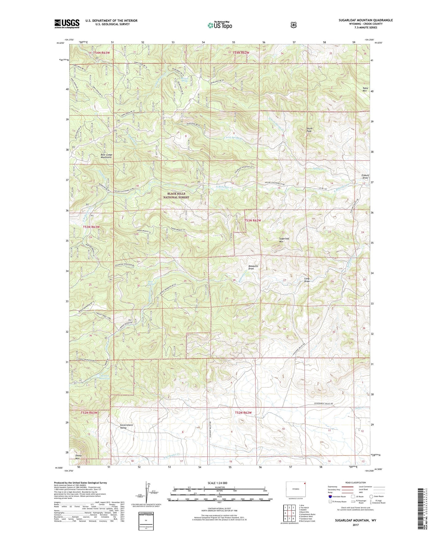
Sugarloaf Mountain Wyoming US Topo Map
Couldn't load pickup availability
Also explore the Sugarloaf Mountain Forest Service Topo of this same quad for updated USFS data
2021 topographic map quadrangle Sugarloaf Mountain in the state of Wyoming. Scale: 1:24000. Based on the newly updated USGS 7.5' US Topo map series, this map is in the following counties: Crook. The map contains contour data, water features, and other items you are used to seeing on USGS maps, but also has updated roads and other features. This is the next generation of topographic maps. Printed on high-quality waterproof paper with UV fade-resistant inks.
Quads adjacent to this one:
West: Black Hills
Northwest: Alva
North: The Notch
Northeast: Aladdin
East: Schoolmarm Butte
Southeast: Red Canyon Creek
South: Sundance East
Southwest: Sundance West
This map covers the same area as the classic USGS quad with code o44104e3.
Contains the following named places: Cow Creek, Dean Spring, Eisbuts Draw, Farrall, Government Valley School, Hemler Reservoir, Lanning Trail, Long Draw, Merrick Spring, Mosquito Draw, North Fork Spring Creek, Onemile Creek, Skunk Peak, South Fork Spring Creek, Spring Creek, Sugarloaf Mountain, Table Mountain, Table Mountain Trail, Twomile Creek