MyTopo
Bridger Peak Wyoming US Topo Map
Couldn't load pickup availability
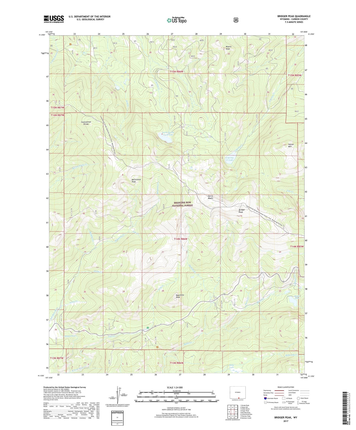
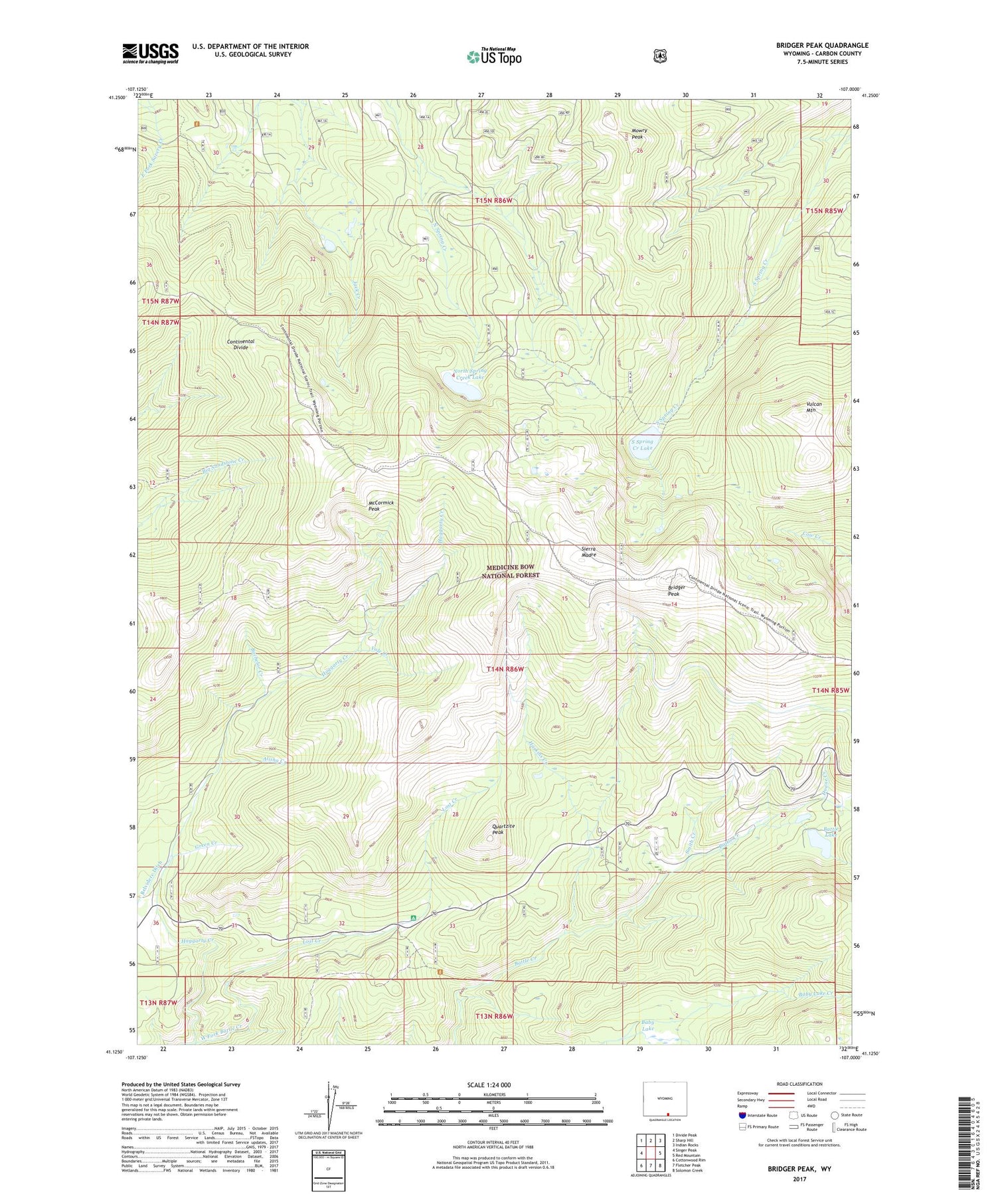
2021 topographic map quadrangle Bridger Peak in the state of Wyoming. Scale: 1:24000. Based on the newly updated USGS 7.5' US Topo map series, this map is in the following counties: Carbon. The map contains contour data, water features, and other items you are used to seeing on USGS maps, but also has updated roads and other features. This is the next generation of topographic maps. Printed on high-quality waterproof paper with UV fade-resistant inks.
Quads adjacent to this one:
West: Singer Peak
Northwest: Divide Peak
North: Sharp Hill
Northeast: Indian Rocks
East: Red Mountain
Southeast: Solomon Creek
South: Fletcher Peak
Southwest: Cottonwood Rim
Contains the following named places: Alisha Creek, Baby Lake, Bachelor Creek, Battle Lake, Big Chief Group Mine, Bridger Peak, Copperton, Creede Property Mine, Dillon, Doan Rambler Mine, Doane Creek, Dreamland King Group Mine, Edison Monument, Ferris-Haggarty Mine, Ferris-Haggerty Mine, Green Creek, Haskins Creek, Haskins Creek Campground, Island City Group Mine, Jack Creek Mine, Lena Shields Group Mine, Lost Creek, Lost Creek Campground, McCormick Peak, Mowry Peak, North Spring Creek Dam, North Spring Creek Lake, North Spring Creek Reservoir, Octavia Prospect, Quartzite Peak, Rambler, Rambler Guard Station, Rudefeha, S Spring Creek Lake Dam, Sierra Madre, Smith Creek, South Spring Creek Lake, South Spring Creek Lake Dam, Vole Creek, Vulcan Mountain