MyTopo
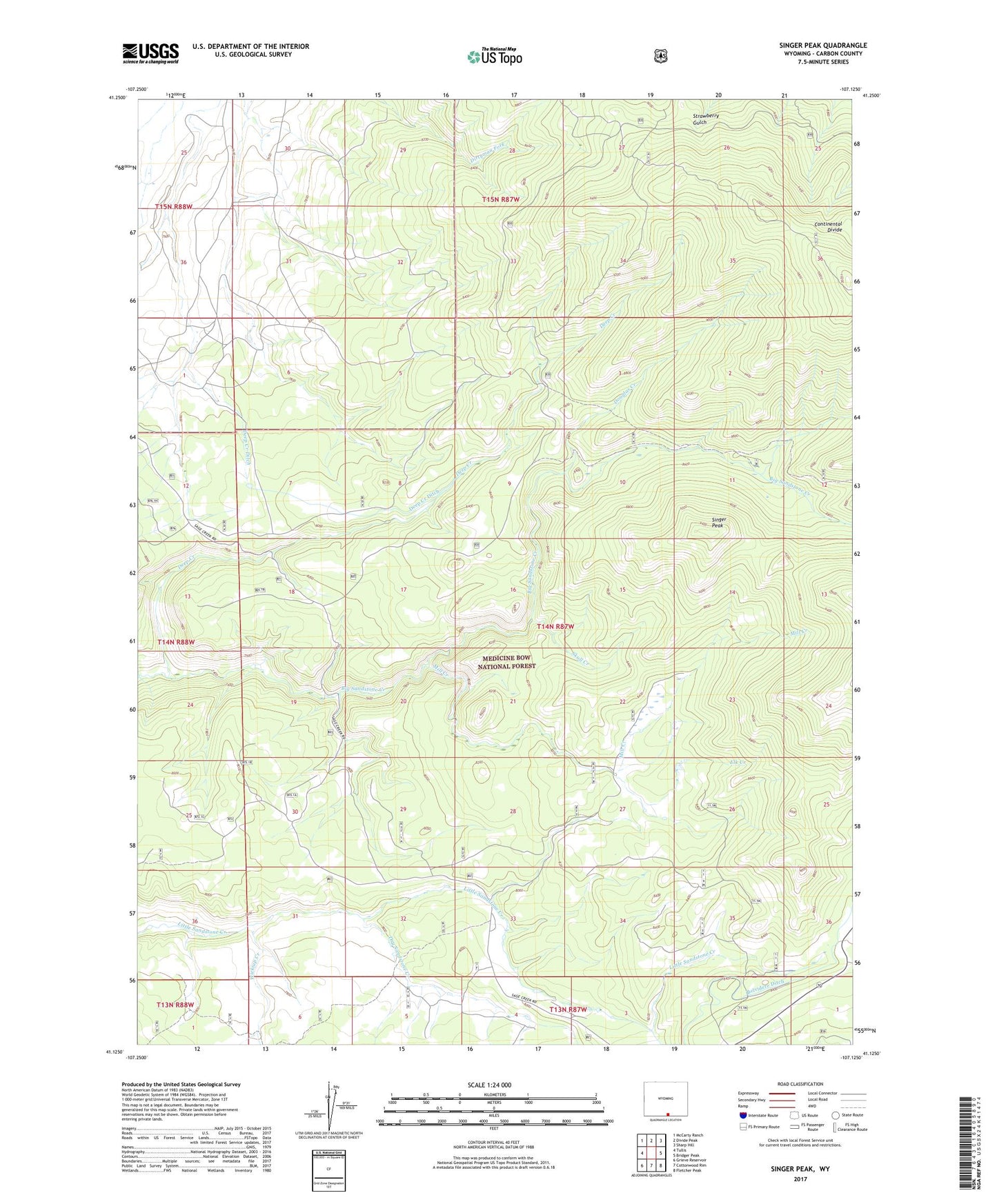
Singer Peak Wyoming US Topo Map
Couldn't load pickup availability
Also explore the Singer Peak Forest Service Topo of this same quad for updated USFS data
2021 topographic map quadrangle Singer Peak in the state of Wyoming. Scale: 1:24000. Based on the newly updated USGS 7.5' US Topo map series, this map is in the following counties: Carbon. The map contains contour data, water features, and other items you are used to seeing on USGS maps, but also has updated roads and other features. This is the next generation of topographic maps. Printed on high-quality waterproof paper with UV fade-resistant inks.
Quads adjacent to this one:
West: Tullis
Northwest: McCarty Ranch
North: Divide Peak
Northeast: Sharp Hill
East: Bridger Peak
Southeast: Fletcher Peak
South: Cottonwood Rim
Southwest: Grieve Reservoir
This map covers the same area as the classic USGS quad with code o41107b2.
Contains the following named places: Deep Creek, Deep Creek Ditch, Douglas Creek, Dry Sandstone Creek, Elk Creek, Gold Coin Prospect, Johnson Ranch, Little Sandstone Campground, Mill Creek, Singer Peak, Skull Creek, Stratton Ranch, Wickiup Creek