MyTopo
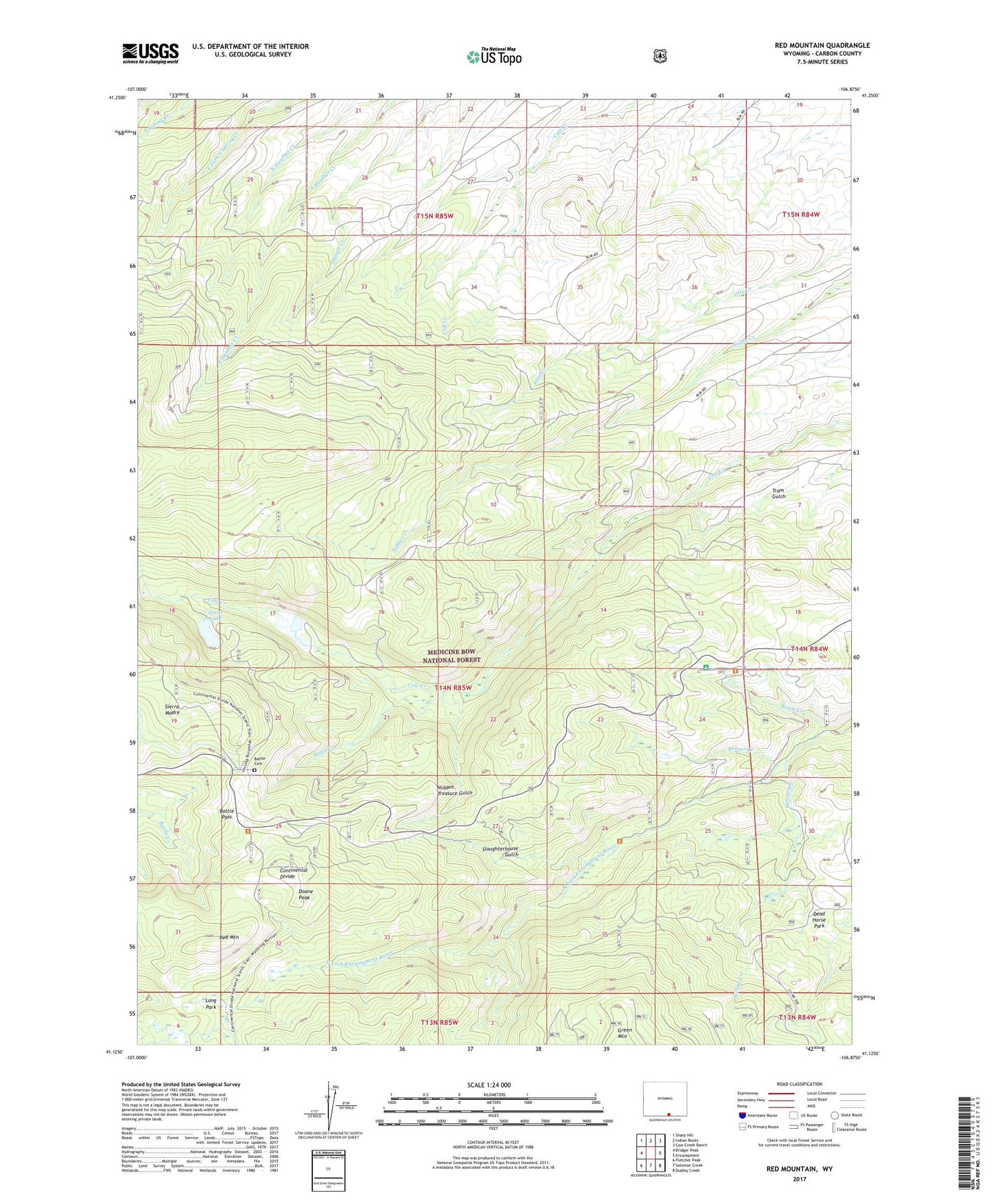
Red Mountain Wyoming US Topo Map
Couldn't load pickup availability
Also explore the Red Mountain Forest Service Topo of this same quad for updated USFS data
2021 topographic map quadrangle Red Mountain in the state of Wyoming. Scale: 1:24000. Based on the newly updated USGS 7.5' US Topo map series, this map is in the following counties: Carbon. The map contains contour data, water features, and other items you are used to seeing on USGS maps, but also has updated roads and other features. This is the next generation of topographic maps. Printed on high-quality waterproof paper with UV fade-resistant inks.
Quads adjacent to this one:
West: Bridger Peak
Northwest: Sharp Hill
North: Indian Rocks
Northeast: Cow Creek Ranch
East: Encampment
Southeast: Dudley Creek
South: Solomon Creek
Southwest: Fletcher Peak
This map covers the same area as the classic USGS quad with code o41106b8.
Contains the following named places: Battle, Battle Area Mine, Battle Cemetery, Battle Pass, Beaver Creek, Beulah Prospect, Big Chief Group Mine, Bonita Prospect Number One, Bonita Prospect Number Two, Bottle Creek, Bottle Creek Campground, Continental Group Mine, Copper Rock Group Mine, Cow Creek Lake Dam, Cow Creek Reservoir, D and L Group Mine, Dead Horse Park, Deadhorse Park, Doane Peak, Elwood, Elwood Post Office, Gertrude Mine, Hidden Treasure Gulch, Hidden Treasure Tunnel Mine, Iron King Prospect, Long Park, Mohawk Prospect One, Mohawk Prospect Two, Nellie Creek, Newton Group Mine, Portland and Hercules Mine, Rambler Mine, Red Mountain, Silver Lake, Silver Lake Dam, Slaughterhouse Gulch, Umslopagus Group Mine, Willow Creek