MyTopo
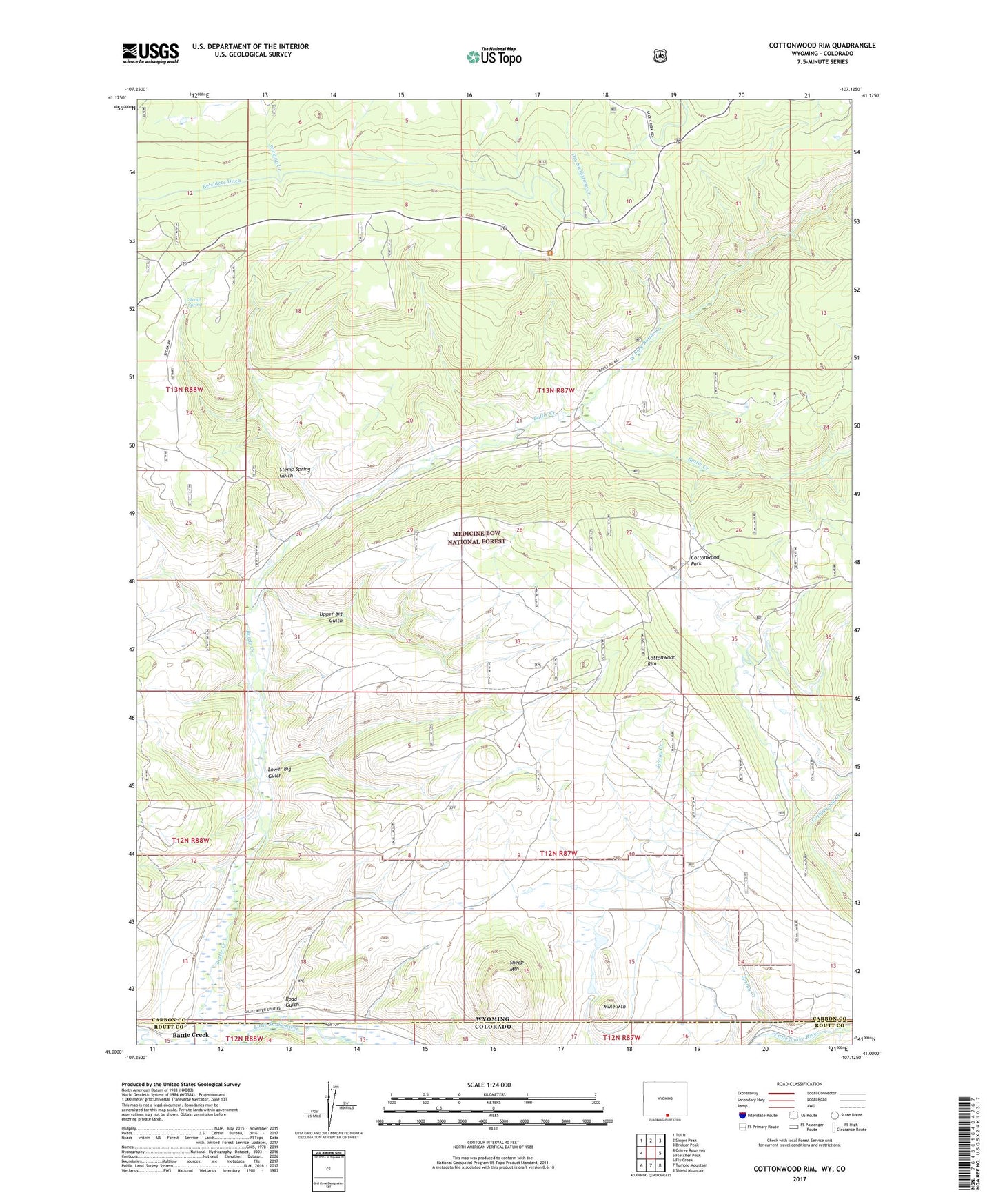
Cottonwood Rim Wyoming US Topo Map
Couldn't load pickup availability
Also explore the Cottonwood Rim Forest Service Topo of this same quad for updated USFS data
2021 topographic map quadrangle Cottonwood Rim in the states of Wyoming, Colorado. Scale: 1:24000. Based on the newly updated USGS 7.5' US Topo map series, this map is in the following counties: Carbon, Routt. The map contains contour data, water features, and other items you are used to seeing on USGS maps, but also has updated roads and other features. This is the next generation of topographic maps. Printed on high-quality waterproof paper with UV fade-resistant inks.
Quads adjacent to this one:
West: Grieve Reservoir
Northwest: Tullis
North: Singer Peak
Northeast: Bridger Peak
East: Fletcher Peak
Southeast: Shield Mountain
South: Tumble Mountain
Southwest: Fly Creek
This map covers the same area as the classic USGS quad with code o41107a2.
Contains the following named places: Battle Creek, Battle Creek Campground, Belvidere Ditch, Carbondale Mine, Cottonwood Park, Cottonwood Rim, Little Cottonwood Creek, Lower Big Gulch, Mule Mountain, Road Gulch, Sandstone Ranger Station, Sheep Mountain, Sheep Mountain Dam, Sheep Mountain Reservoir, Spring Creek, Stemp Spring, Stemp Spring Gulch, Stemp Springs Mine, Upper Big Gulch, West Fork Battle Creek