MyTopo
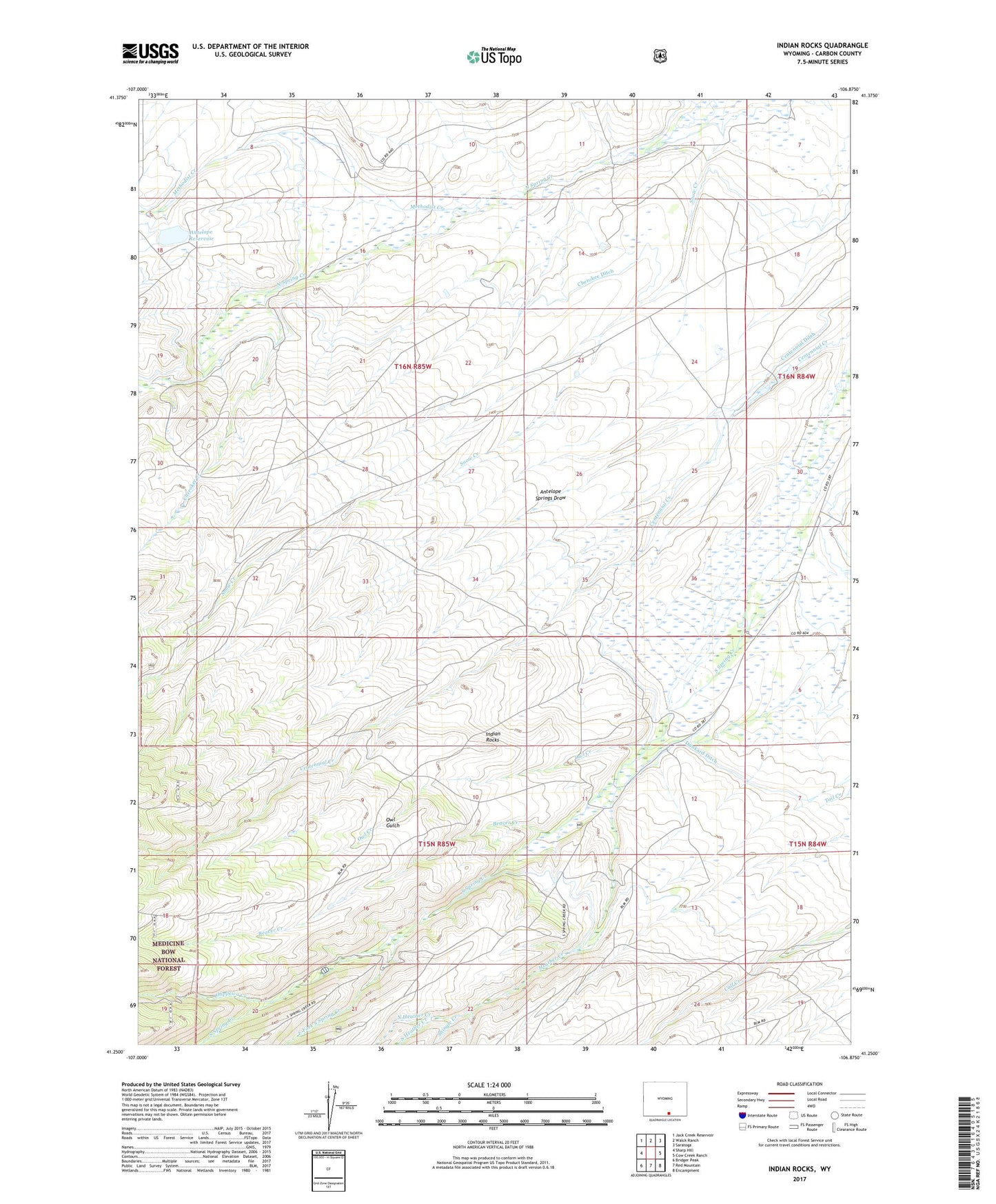
Indian Rocks Wyoming US Topo Map
Couldn't load pickup availability
Also explore the Indian Rocks Forest Service Topo of this same quad for updated USFS data
2021 topographic map quadrangle Indian Rocks in the state of Wyoming. Scale: 1:24000. Based on the newly updated USGS 7.5' US Topo map series, this map is in the following counties: Carbon. The map contains contour data, water features, and other items you are used to seeing on USGS maps, but also has updated roads and other features. This is the next generation of topographic maps. Printed on high-quality waterproof paper with UV fade-resistant inks.
Quads adjacent to this one:
West: Sharp Hill
Northwest: Jack Creek Reservoir
North: Walck Ranch
Northeast: Saratoga
East: Cow Creek Ranch
Southeast: Encampment
South: Red Mountain
Southwest: Bridger Peak
This map covers the same area as the classic USGS quad with code o41106c8.
Contains the following named places: Antelope Dam, Antelope Reservoir, Antelope Springs Draw, Bartlett Ranch, Bath Ranch, Beaver Creek, Berger Ranch, C Swanson Ranch, Cherokee Creek, Cherokee Ditch, Chippewa Creek, Cozy Canyon Ranch, Dunkard Ditch, East Fork South Spring Creek, Heather Creek, Indian Rocks, Methodist Creek, Mowry Ranch, North Heather Creek, Owl Creek, Owl Gulch, Shingle Creek, South Heather Creek, V Swanson Ranch, Waliser Ranch