MyTopo
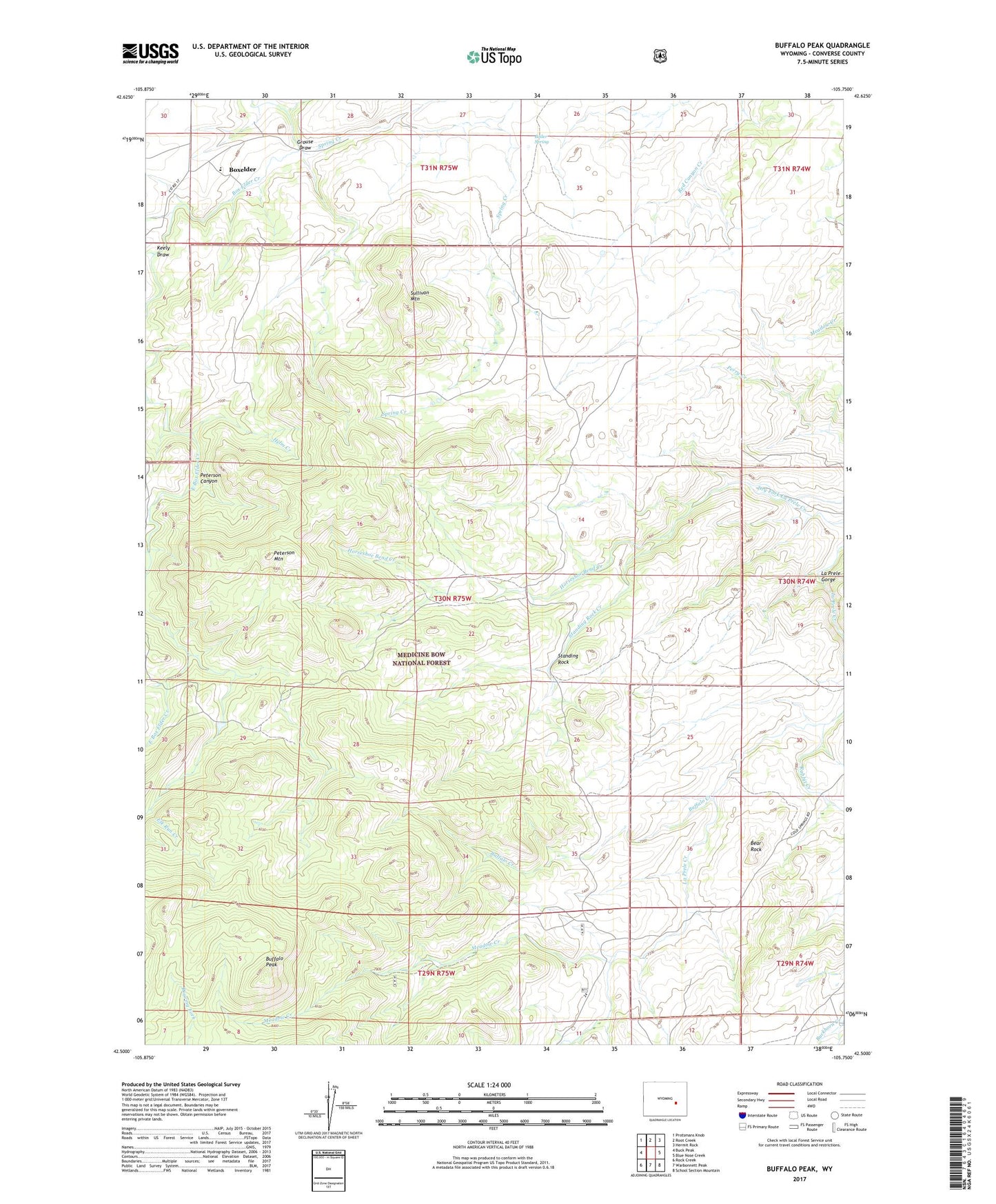
Buffalo Peak Wyoming US Topo Map
Couldn't load pickup availability
Also explore the Buffalo Peak Forest Service Topo of this same quad for updated USFS data
2021 topographic map quadrangle Buffalo Peak in the state of Wyoming. Scale: 1:24000. Based on the newly updated USGS 7.5' US Topo map series, this map is in the following counties: Converse. The map contains contour data, water features, and other items you are used to seeing on USGS maps, but also has updated roads and other features. This is the next generation of topographic maps. Printed on high-quality waterproof paper with UV fade-resistant inks.
Quads adjacent to this one:
West: Buck Peak
Northwest: Protsmans Knob
North: Root Creek
Northeast: Hermit Rock
East: Blue Nose Creek
Southeast: School Section Mountain
South: Warbonnett Peak
Southwest: Rock Creek
This map covers the same area as the classic USGS quad with code o42105e7.
Contains the following named places: Bear Rock, Boiler Spring, Boxelder, Buffalo Creek, Buffalo Peak, Crazy Horse Creek, East Box Elder Creek, Elk Lake, French Creek, Grouse Draw, Helm Creek, Horseshoe Bend Creek, Keely Draw, La Prele Gorge, Meadow Creek, Olins Lode, Peterson Canyon, Peterson Mountain, Rabbit Creek, Silver Spruce Lodge, Snowshoe Creek, Spring Creek, Standing Rock, Standing Rock Creek, Sullivan Mountain