MyTopo
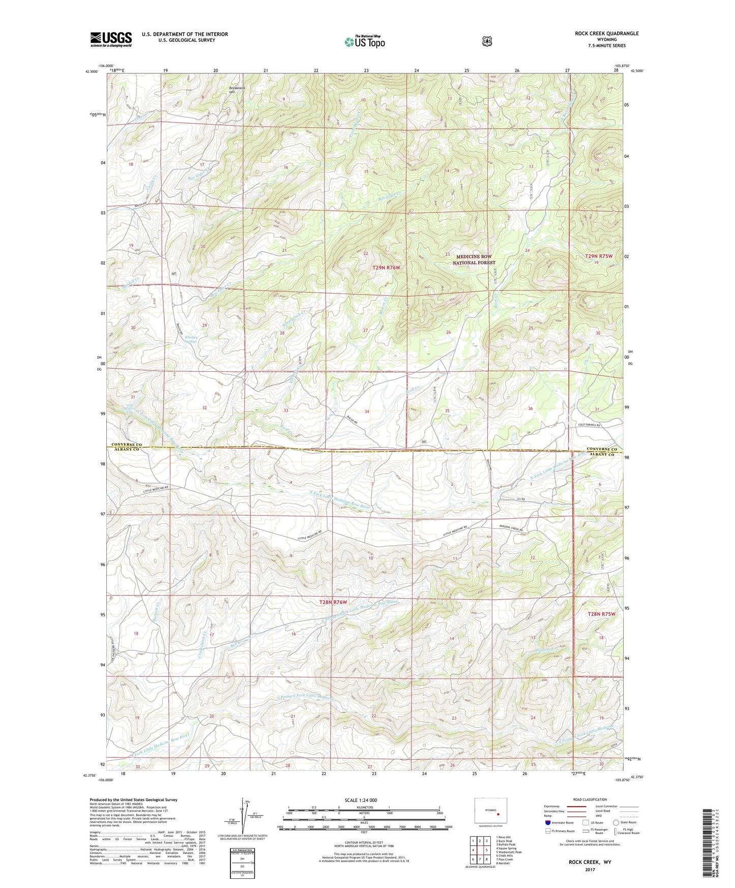
Rock Creek Wyoming US Topo Map
Couldn't load pickup availability
Also explore the Rock Creek Forest Service Topo of this same quad for updated USFS data
2021 topographic map quadrangle Rock Creek in the state of Wyoming. Scale: 1:24000. Based on the newly updated USGS 7.5' US Topo map series, this map is in the following counties: Converse, Albany. The map contains contour data, water features, and other items you are used to seeing on USGS maps, but also has updated roads and other features. This is the next generation of topographic maps. Printed on high-quality waterproof paper with UV fade-resistant inks.
Quads adjacent to this one:
West: Squaw Spring
Northwest: Reno Hill
North: Buck Peak
Northeast: Buffalo Peak
East: Warbonnett Peak
Southeast: Marshall
South: Pass Creek
Southwest: Chalk Hills
This map covers the same area as the classic USGS quad with code o42105d8.
Contains the following named places: Beaver Creek, Bell Creek, Breakneck Hill, Cruikshank Creek, Elkhorn Creek, Little Beaver Creek, Little Medicine, Little Medicine Falls, North Prong South Fork Little Medicine Bow River, Parsons Creek, Rock Creek, Russells Camp, Sleepy Jack Creek, South Prong South Fork Little Medicine, The Peach Orchard, Whiskey Springs