MyTopo
Buffalo Run Creek Wyoming US Topo Map
Couldn't load pickup availability
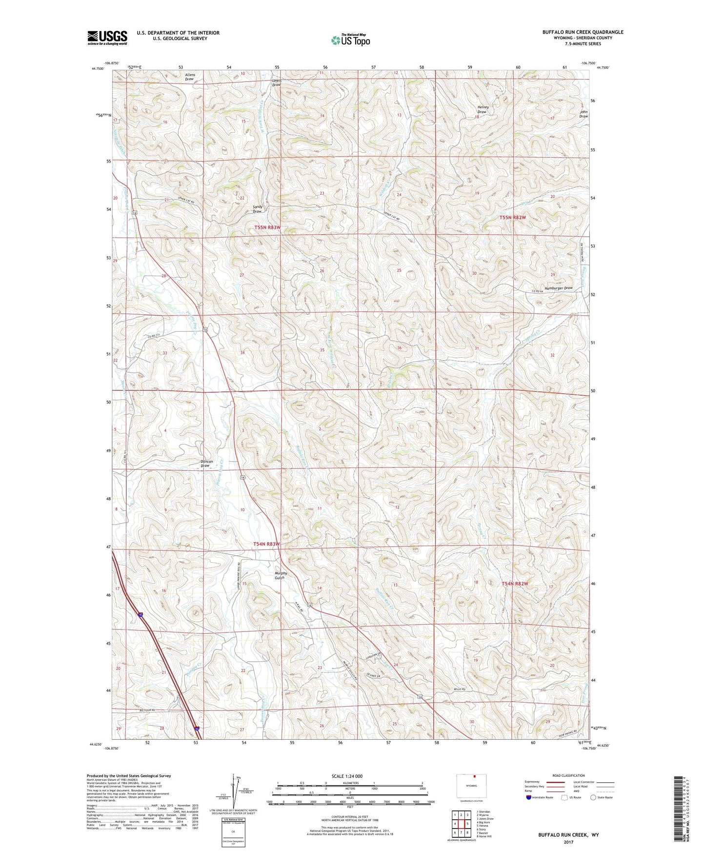
2021 topographic map quadrangle Buffalo Run Creek in the state of Wyoming. Scale: 1:24000. Based on the newly updated USGS 7.5' US Topo map series, this map is in the following counties: Sheridan. The map contains contour data, water features, and other items you are used to seeing on USGS maps, but also has updated roads and other features. This is the next generation of topographic maps. Printed on high-quality waterproof paper with UV fade-resistant inks.
Quads adjacent to this one:
West: Big Horn
Northwest: Sheridan
North: Wyarno
Northeast: Jones Draw
East: Verona
Southeast: Horse Hill
South: Banner
Southwest: Story
Contains the following named places: Betheurem Prospect Mine, Brush Creek, Buffalo Run Creek, Duncan Draw, Hamburger Draw, Jim Creek, John Draw, Johnson Creek, Lewis Draw, Maxwell Dam, Maxwell Reservoir, Meade Creek, Murphy Gulch, Pompey Creek, Sandy Draw, Spring Creek