MyTopo
Moonshine Peak Wyoming US Topo Map
Couldn't load pickup availability
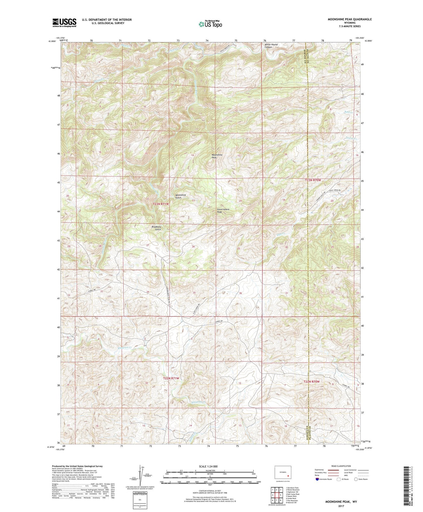
2021 topographic map quadrangle Moonshine Peak in the state of Wyoming. Scale: 1:24000. Based on the newly updated USGS 7.5' US Topo map series, this map is in the following counties: Albany, Platte. The map contains contour data, water features, and other items you are used to seeing on USGS maps, but also has updated roads and other features. This is the next generation of topographic maps. Printed on high-quality waterproof paper with UV fade-resistant inks.
Quads adjacent to this one:
West: Bull Camp Peak
Northwest: Davidson Flats
North: Reese Mountain
Northeast: Hightower SW
East: Squaw Rock
Southeast: Natwick SW
South: Poe Mountain
Southwest: Guide Rock
This map covers the same area as the classic USGS quad with code o41105h3.
Contains the following named places: Adam Boyd Ranch, Bookout Ranch, Bradbury Gulch, Duck Creek, Emerald Group Mine, George Creek Mine, Government Peak, Groves and Collins Deposit, Halleck Canyon Area Mine, Halleck Creek, Meadow Spring Ranch, Moonshine Gulch, Moonshine Peak, Plaga-Judd Deposit, Romsa Dolomite Deposit, Schreyer Ranch, White Hound Canyon, William Boyd Ranch