MyTopo
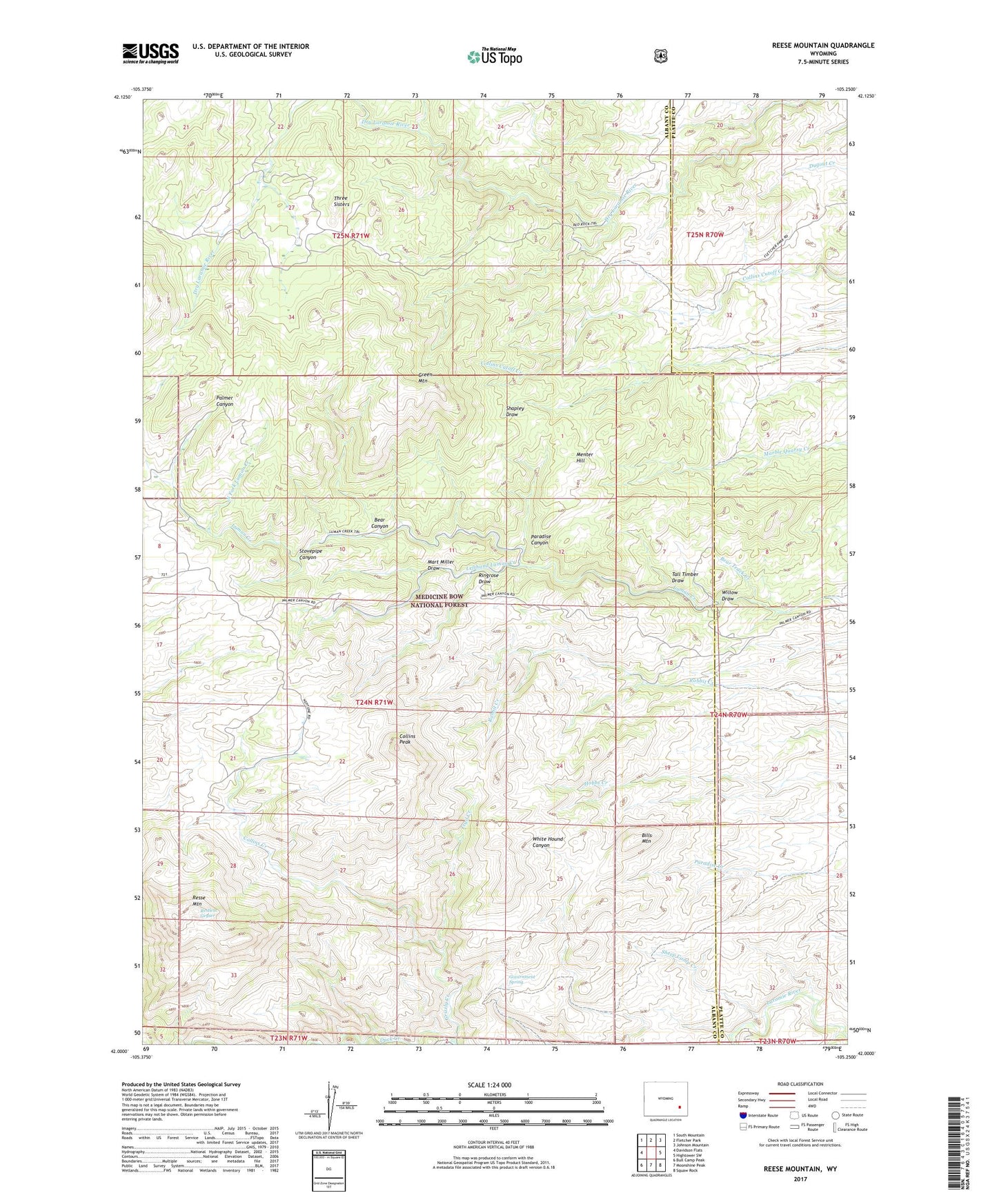
Reese Mountain Wyoming US Topo Map
Couldn't load pickup availability
Also explore the Reese Mountain Forest Service Topo of this same quad for updated USFS data
2021 topographic map quadrangle Reese Mountain in the state of Wyoming. Scale: 1:24000. Based on the newly updated USGS 7.5' US Topo map series, this map is in the following counties: Albany, Platte. The map contains contour data, water features, and other items you are used to seeing on USGS maps, but also has updated roads and other features. This is the next generation of topographic maps. Printed on high-quality waterproof paper with UV fade-resistant inks.
Quads adjacent to this one:
West: Davidson Flats
Northwest: South Mountain
North: Fletcher Park
Northeast: Johnson Mountain
East: Hightower SW
Southeast: Squaw Rock
South: Moonshine Peak
Southwest: Bull Camp Peak
This map covers the same area as the classic USGS quad with code o42105a3.
Contains the following named places: Bear Canyon, Bear Track Creek, Bills Mountain, Cherry Creek, Collins Creek, Collins Peak, Government Spring, Green Mountain, Grizzly Creek, Grizzly Creek Prospect, Lefthand Luman Creek, Long Jack Claim, Mart Miller Draw, May Deposit, Menter Hill, North Fork Luman Creek, Palmer Canyon, Palmer Canyon Mine, Paradise Canyon, Resse Mountain, Restless Geyser, Ringrose Draw, Roff Deposit, Sheep Camp Creek, Stovepipe Canyon, Tall Timber Draw, Three Sisters, Trail Creek, Willow Draw