MyTopo
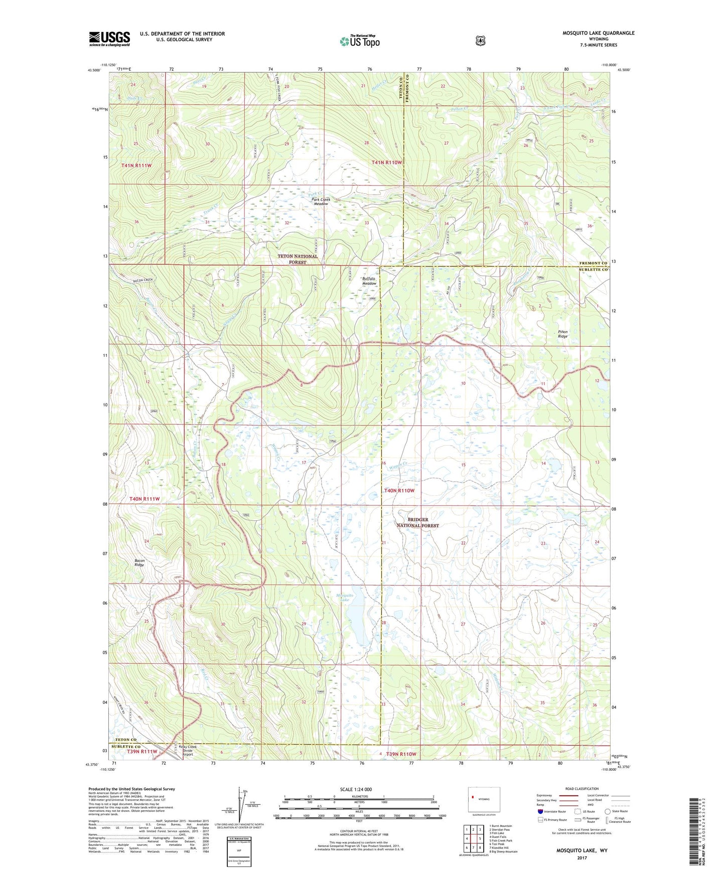
Mosquito Lake Wyoming US Topo Map
Couldn't load pickup availability
Also explore the Mosquito Lake Forest Service Topo of this same quad for updated USFS data
2021 topographic map quadrangle Mosquito Lake in the state of Wyoming. Scale: 1:24000. Based on the newly updated USGS 7.5' US Topo map series, this map is in the following counties: Teton, Sublette, Fremont. The map contains contour data, water features, and other items you are used to seeing on USGS maps, but also has updated roads and other features. This is the next generation of topographic maps. Printed on high-quality waterproof paper with UV fade-resistant inks.
Quads adjacent to this one:
West: Ouzel Falls
Northwest: Burnt Mountain
North: Sheridan Pass
Northeast: Fish Lake
East: Fish Creek Park
Southeast: Big Sheep Mountain
South: Klondike Hill
Southwest: Tosi Peak
This map covers the same area as the classic USGS quad with code o43110d1.
Contains the following named places: Bacon Ridge, Buffalo Meadow, Kinky Creek Divide Airport, Leeds Creek, Mosquito Lake, Negro Creek, Park Creek, Park Creek Meadow, Pass Creek Trail, Pelton Creek, Raspberry Creek