MyTopo
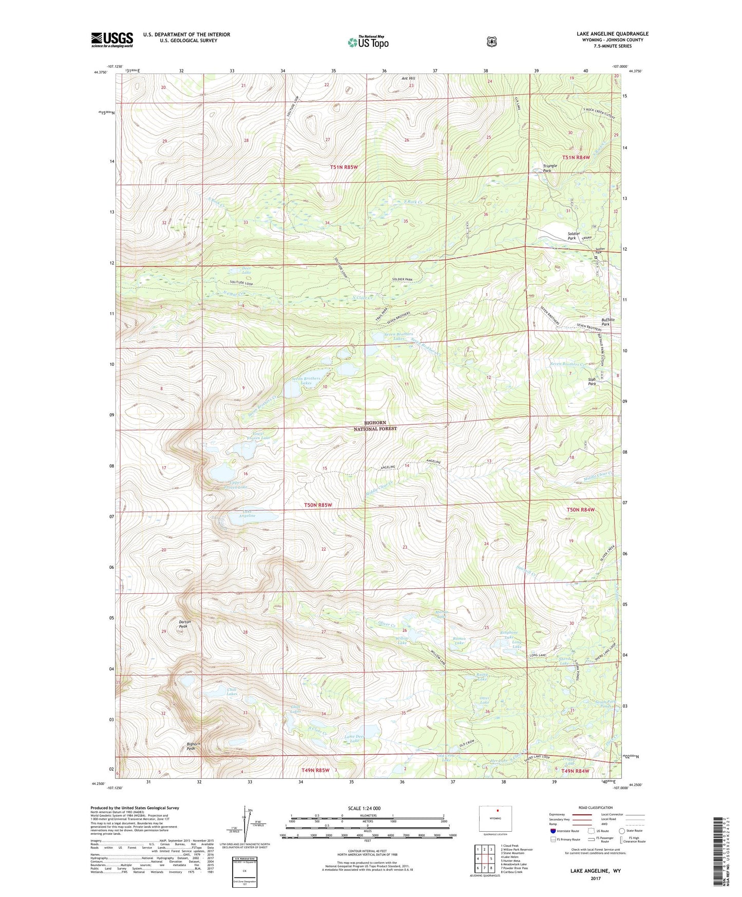
Lake Angeline Wyoming US Topo Map
Couldn't load pickup availability
Also explore the Lake Angeline Forest Service Topo of this same quad for updated USFS data
2021 topographic map quadrangle Lake Angeline in the state of Wyoming. Scale: 1:24000. Based on the newly updated USGS 7.5' US Topo map series, this map is in the following counties: Johnson. The map contains contour data, water features, and other items you are used to seeing on USGS maps, but also has updated roads and other features. This is the next generation of topographic maps. Printed on high-quality waterproof paper with UV fade-resistant inks.
Quads adjacent to this one:
West: Lake Helen
Northwest: Cloud Peak
North: Willow Park Reservoir
Northeast: Stone Mountain
East: Hunter Mesa
Southeast: Caribou Creek
South: Powder River Pass
Southwest: Meadowlark Lake
This map covers the same area as the classic USGS quad with code o44107c1.
Contains the following named places: Angeline Trail, Ant Hill, Bighorn Peak, Chill Lakes, Darton Peak, Deer Lake, Her Lake, Lake Angeline, Lame Deer Lake, Long Lake, Lower Frozen Lake, Martin Lake, North Fork Trailhead, Old Crow Lake, Otter Lake, Pass Creek, Rainy Lake, Ringbone Lake, Romeo Lake, Sawmill Creek, Seven Brothers Lakes, Sherd Lake, Slab Park, Soldier Park, Soldier Park Cemetery, South Fork Pond Dam, South Fork Ponds, Triangle Park, Trigger Lake, Upper Frozen Lake, Willow Lake