MyTopo
Casebier Hill Wyoming US Topo Map
Couldn't load pickup availability
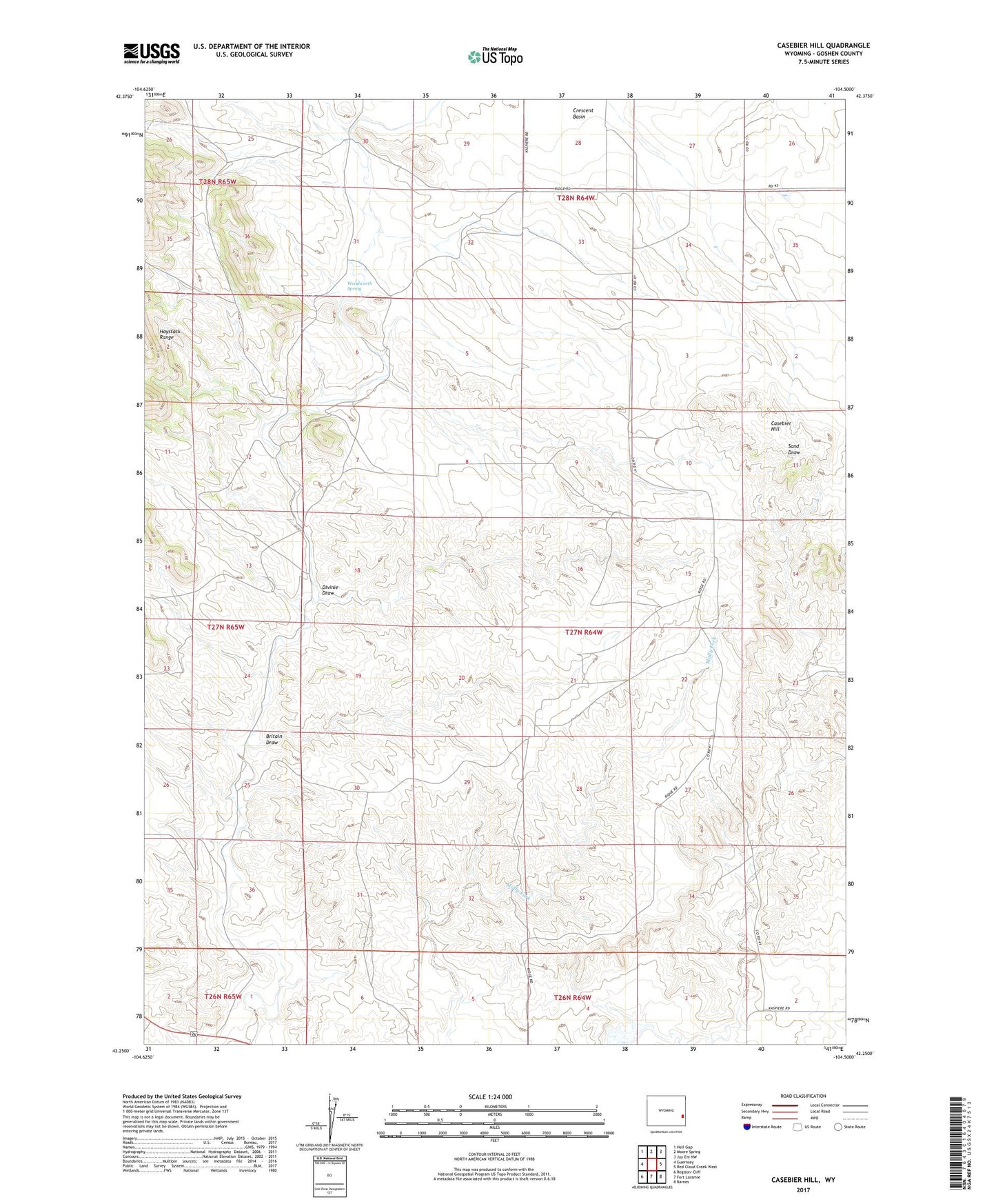
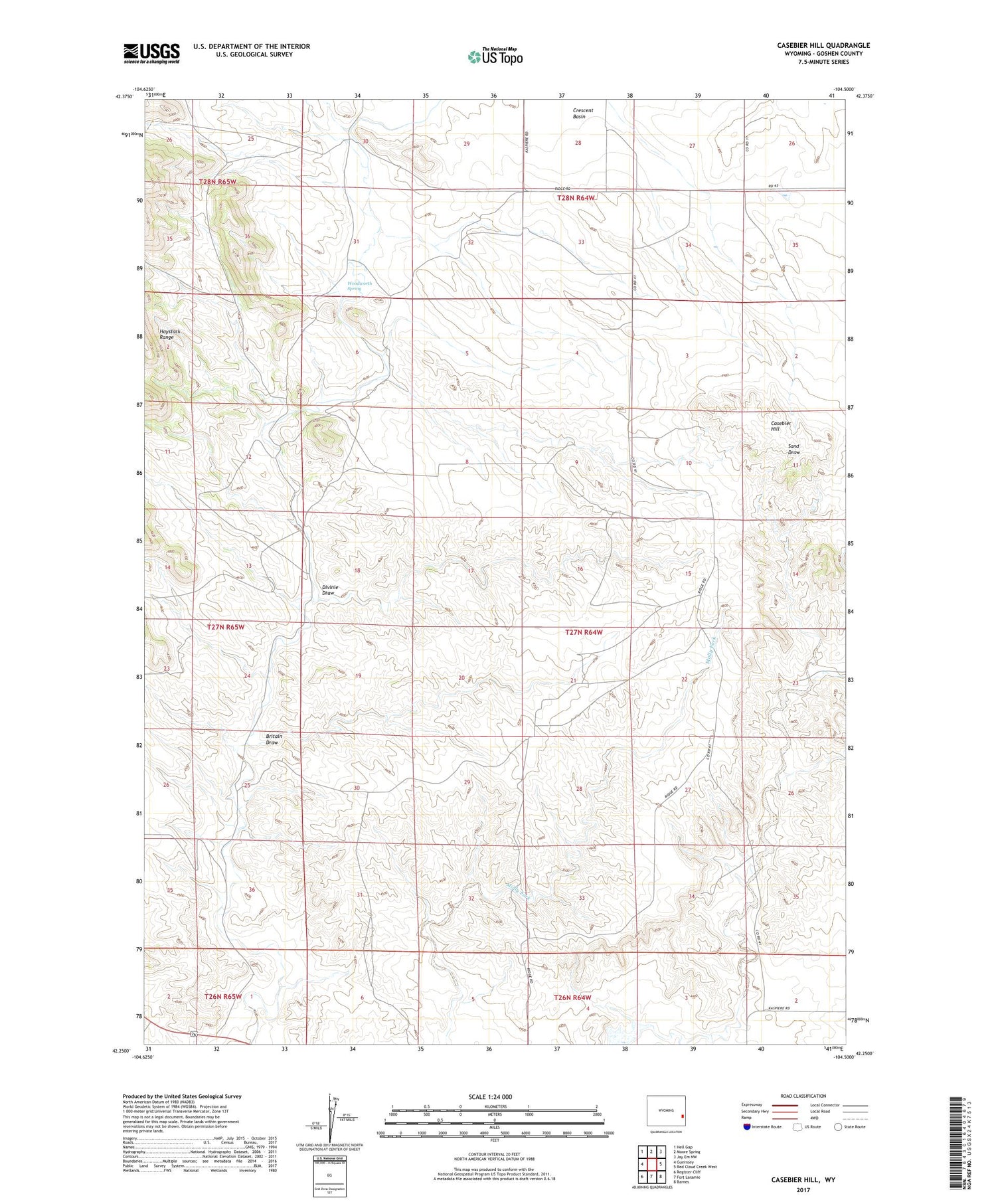
2021 topographic map quadrangle Casebier Hill in the state of Wyoming. Scale: 1:24000. Based on the newly updated USGS 7.5' US Topo map series, this map is in the following counties: Goshen. The map contains contour data, water features, and other items you are used to seeing on USGS maps, but also has updated roads and other features. This is the next generation of topographic maps. Printed on high-quality waterproof paper with UV fade-resistant inks.
Quads adjacent to this one:
West: Guernsey
Northwest: Hell Gap
North: Moore Spring
Northeast: Jay Em NW
East: Red Cloud Creek West
Southeast: Barnes
South: Fort Laramie
Southwest: Register Cliff
Contains the following named places: Britain Draw, Casebier Hill, Chicago Prospect, Detention Reservoir Case Bier 1, Divinie Draw, Haystack Number One Claim, Haystack Number Two Claim, Meyers Ranch, Minnie Claims, Walsh Dam, Walsh Reservoir, Woodworth Spring, ZIP Code: 82212