MyTopo
Fort Laramie Wyoming US Topo Map
Couldn't load pickup availability
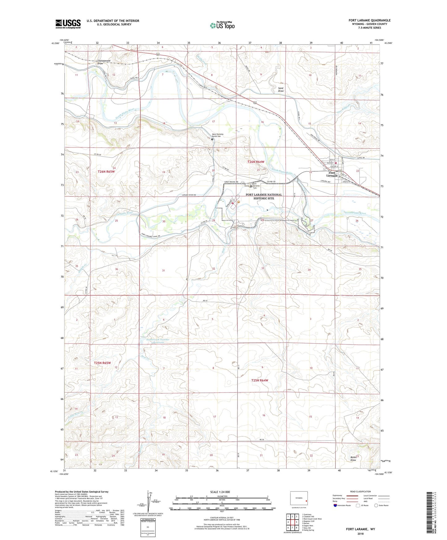
2021 topographic map quadrangle Fort Laramie in the state of Wyoming. Scale: 1:24000. Based on the newly updated USGS 7.5' US Topo map series, this map is in the following counties: Goshen. The map contains contour data, water features, and other items you are used to seeing on USGS maps, but also has updated roads and other features. This is the next generation of topographic maps. Printed on high-quality waterproof paper with UV fade-resistant inks.
Quads adjacent to this one:
West: Register Cliff
Northwest: Guernsey
North: Casebier Hill
Northeast: Red Cloud Creek West
East: Barnes
Southeast: Habig Spring
South: Doty Hill
Southwest: Eagles Nest
This map covers the same area as the classic USGS quad with code o42104b5.
Contains the following named places: Cottonwood Draw, Deer Creek, Detention Case Bier 1 Dam, Detention Pine Ridge 1 Dam, Fort Laramie, Fort Laramie Cemetery, Fort Laramie Middle School, Fort Laramie National Historic Site, Fort Laramie National Historic Site Fire Brigade, Fort Laramie Post Office, Goshen County Fire District 12E - Fort Laramie Volunteer Fire Department, Gross Reservoir, Laramie River, Little Deer Creek, Mary Homsley Burial Site, Molly Fork, Pine Ridge Creek, Sand Draw, Sandercock Dam, Sandercock Number 3 Dam, Sandercock Reservoir, Sixmile Creek, Town of Fort Laramie