MyTopo
Barnes Wyoming US Topo Map
Couldn't load pickup availability
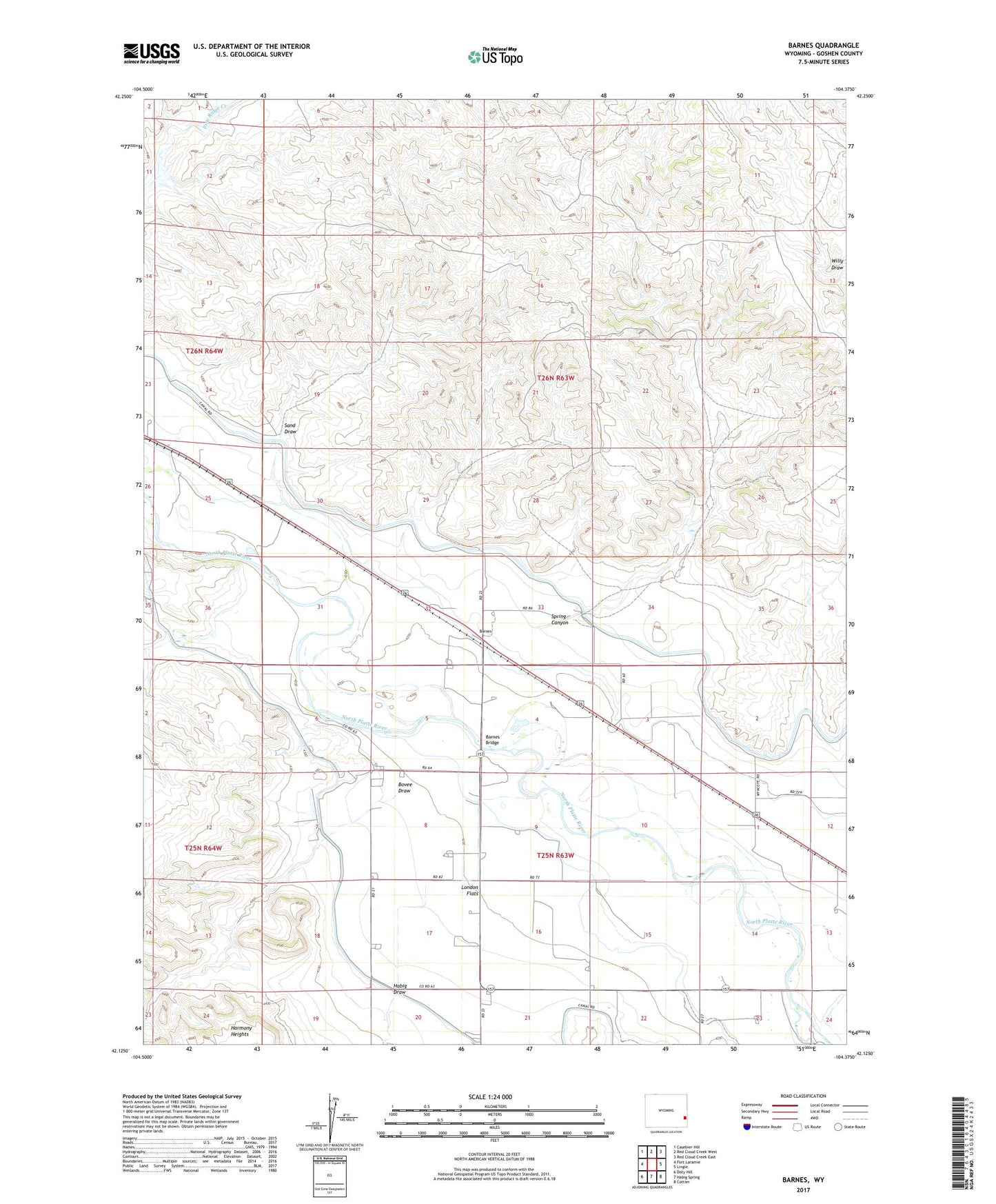
2021 topographic map quadrangle Barnes in the state of Wyoming. Scale: 1:24000. Based on the newly updated USGS 7.5' US Topo map series, this map is in the following counties: Goshen. The map contains contour data, water features, and other items you are used to seeing on USGS maps, but also has updated roads and other features. This is the next generation of topographic maps. Printed on high-quality waterproof paper with UV fade-resistant inks.
Quads adjacent to this one:
West: Fort Laramie
Northwest: Casebier Hill
North: Red Cloud Creek West
Northeast: Red Cloud Creek East
East: Lingle
Southeast: Cottier
South: Habig Spring
Southwest: Doty Hill
This map covers the same area as the classic USGS quad with code o42104b4.
Contains the following named places: Barnes, Barnes Bridge, Bovee Draw, Detention Dam B-2, Detention Dam B-2 Reservoir, Detention Dike B-3 Dam, Detention Dike B-3 Reservoir, Grattan Ditch, Grattan Massacre Historical Monument, Habig Draw, London Flats, Sand Draw, Skinner Ranch, Spring Canyon, ZIP Code: 82223