MyTopo
Shawnee Wyoming US Topo Map
Couldn't load pickup availability
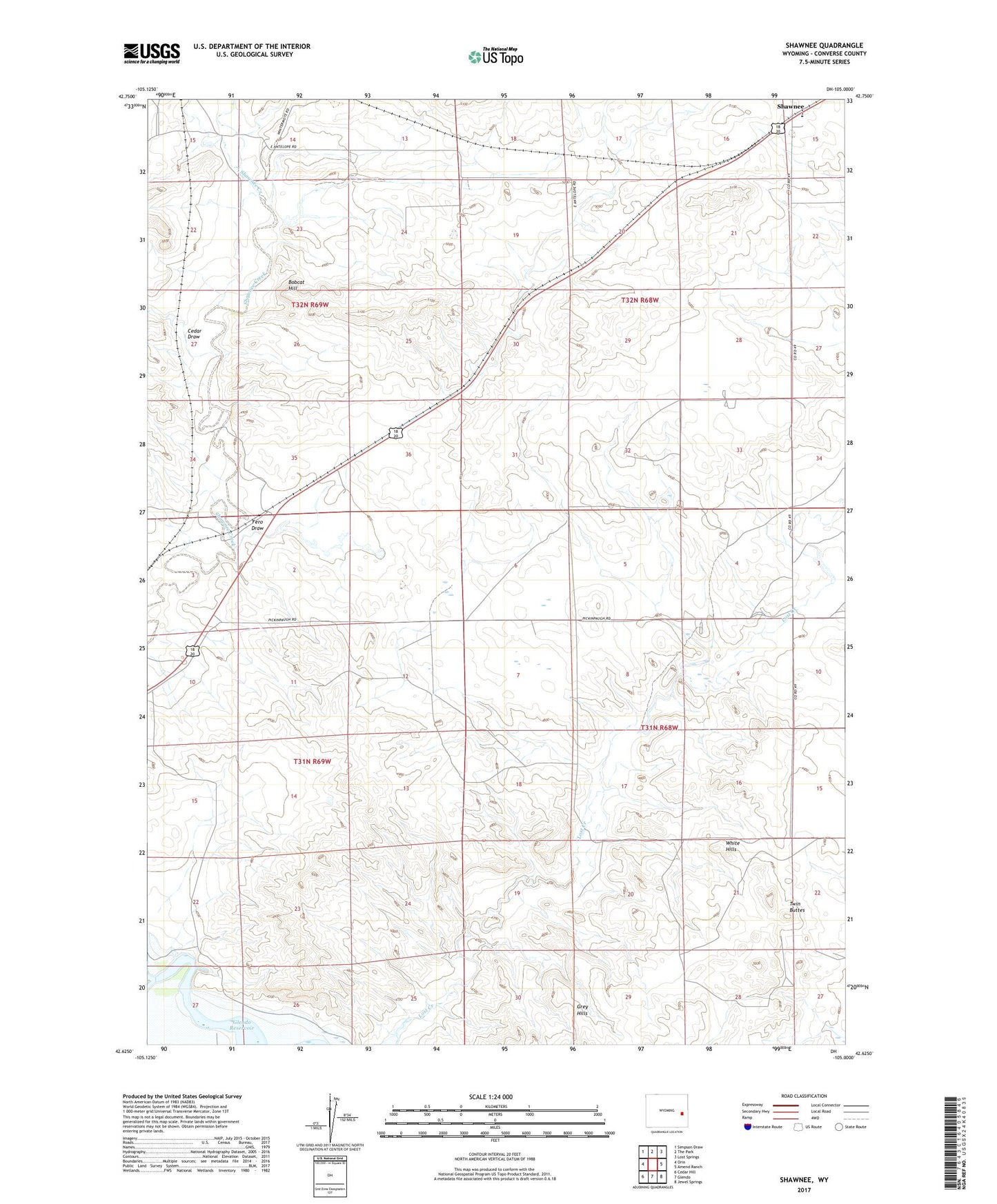
2021 topographic map quadrangle Shawnee in the state of Wyoming. Scale: 1:24000. Based on the newly updated USGS 7.5' US Topo map series, this map is in the following counties: Converse. The map contains contour data, water features, and other items you are used to seeing on USGS maps, but also has updated roads and other features. This is the next generation of topographic maps. Printed on high-quality waterproof paper with UV fade-resistant inks.
Quads adjacent to this one:
West: Orin
Northwest: Simpson Draw
North: The Park
Northeast: Lost Springs
East: Amend Ranch
Southeast: Jewel Springs
South: Glendo
Southwest: Cedar Hill
This map covers the same area as the classic USGS quad with code o42105f1.
Contains the following named places: Bobcat Hill, Cedar Draw, Deadmans Corner, East Fork Shawnee Creek, Faith Number Two and Three Mine, Fero Draw, Fisher, Fox Numbers Eight and Ten Mine, Grey Hills, Kornegay Homestead, Lane Homestead, May Homestead, Mickey One Mine, Nelson Homestead, Pickinpaugh Homestead, Shawnee, Twin Buttes, West Fork Shawnee Creek, White Hills, Worthington Homestead, XH Crossing