MyTopo
Storm Draw Wyoming US Topo Map
Couldn't load pickup availability
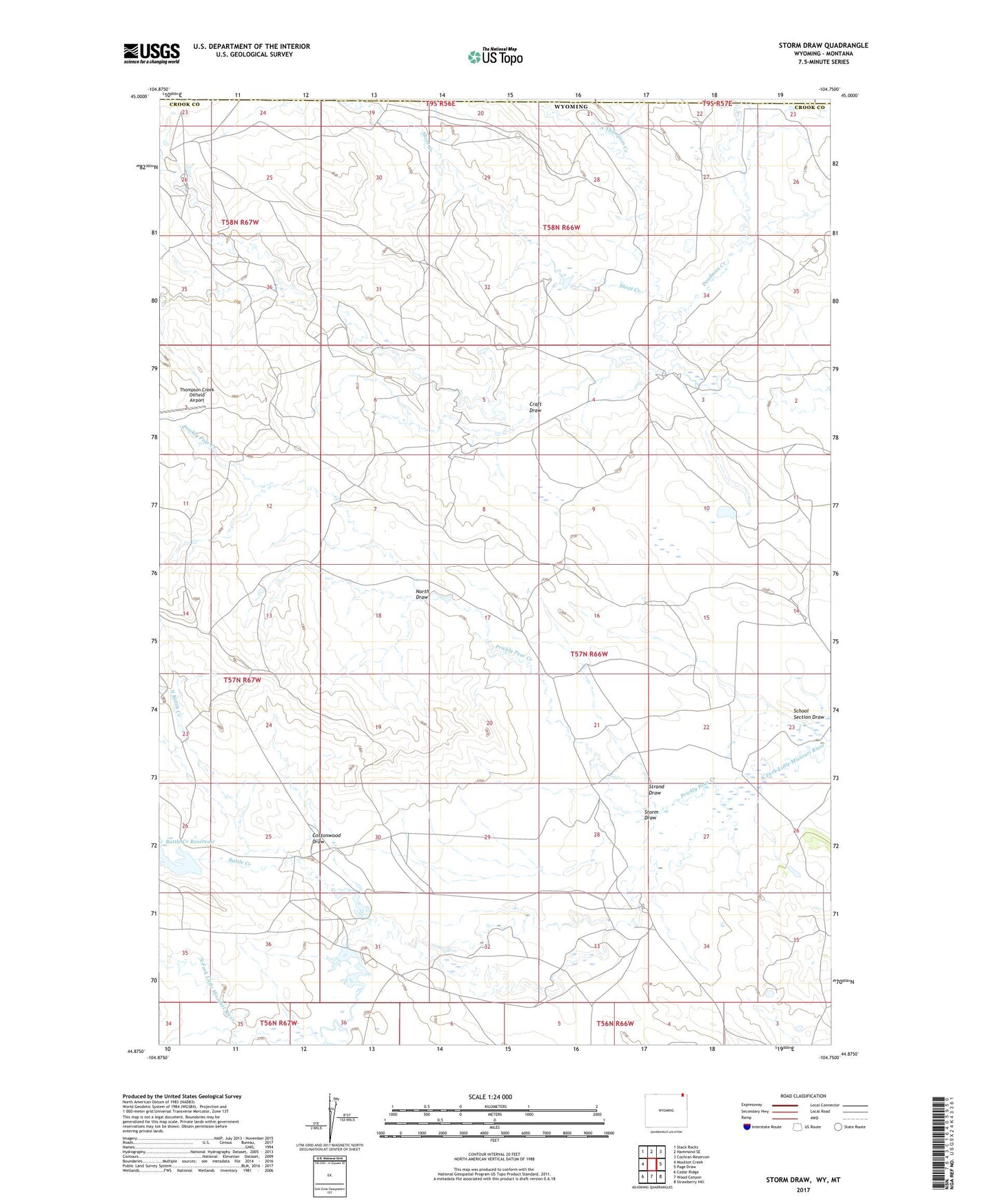
2021 topographic map quadrangle Storm Draw in the states of Wyoming, Montana. Scale: 1:24000. Based on the newly updated USGS 7.5' US Topo map series, this map is in the following counties: Crook, Carter. The map contains contour data, water features, and other items you are used to seeing on USGS maps, but also has updated roads and other features. This is the next generation of topographic maps. Printed on high-quality waterproof paper with UV fade-resistant inks.
Quads adjacent to this one:
West: Moulton Creek
Northwest: Stack Rocks
North: Hammond SE
Northeast: Cochran Reservoir
East: Page Draw
Southeast: Strawberry Hill
South: Wood Canyon
Southwest: Cedar Ridge
This map covers the same area as the classic USGS quad with code o44104h7.
Contains the following named places: Battle Creek, Battle Creek Dam, Battle Creek Reservoir, Bush Ranch Dam, Cedar Creek, Cottonwood Draw, Craft Draw, Deadman Creek, Leonard Ranch, Linch Ranch, North Battle Creek, North Draw, North Thompson Creek, Pierce Ranch, Prickly Pear Creek, School Section Draw, Short Creek, Storm Draw, Storm Ranch, Storm School, Strand Draw, Thompson Creek School, Tract 37 Dam, Tract 37 Reservoir