MyTopo
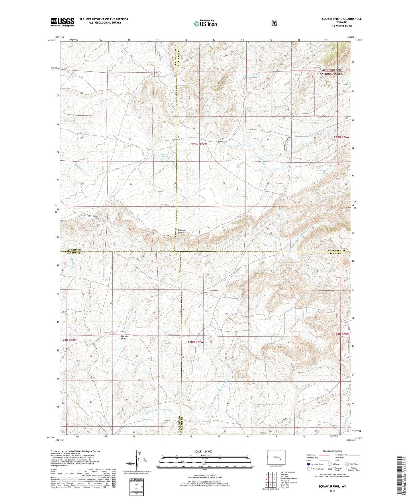
Squaw Spring Wyoming US Topo Map
Couldn't load pickup availability
Also explore the Squaw Spring Forest Service Topo of this same quad for updated USFS data
2023 topographic map quadrangle Squaw Spring in the state of Wyoming. Scale: 1:24000. Based on the newly updated USGS 7.5' US Topo map series, this map is in the following counties: Converse, Albany, Natrona, Carbon. The map contains contour data, water features, and other items you are used to seeing on USGS maps, but also has updated roads and other features. This is the next generation of topographic maps. Printed on high-quality waterproof paper with UV fade-resistant inks.
Quads adjacent to this one:
West: Bates Creek Reservoir
Northwest: Ice Cave Mountain
North: Reno Hill
Northeast: Buck Peak
East: Rock Creek
Southeast: Pass Creek
South: Chalk Hills
Southwest: Moss Agate Reservoir
This map covers the same area as the classic USGS quad with code o42106d1.
Contains the following named places: Brennan Draw, Curry Creek, Dugway Rim, Eggleston Homestead, Higginson Homestead, Little Medicine School, North Fork Little Medicine Bow River, Old Kamp Place, Sandell Creek, South Fork Little Medicine Bow River, Squaw Spring, Taylor Ranch, Texas Creek