MyTopo
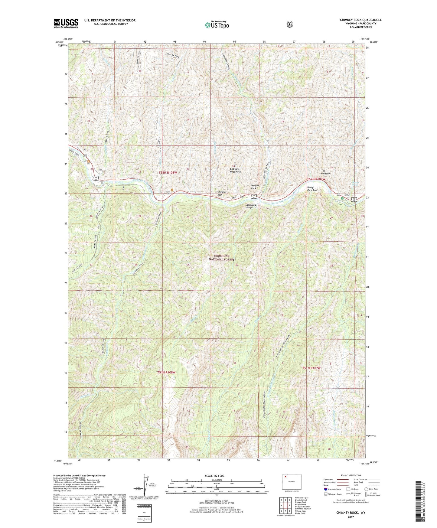
Chimney Rock Wyoming US Topo Map
Couldn't load pickup availability
Also explore the Chimney Rock Forest Service Topo of this same quad for updated USFS data
2021 topographic map quadrangle Chimney Rock in the state of Wyoming. Scale: 1:24000. Based on the newly updated USGS 7.5' US Topo map series, this map is in the following counties: Park. The map contains contour data, water features, and other items you are used to seeing on USGS maps, but also has updated roads and other features. This is the next generation of topographic maps. Printed on high-quality waterproof paper with UV fade-resistant inks.
Quads adjacent to this one:
West: Eagle Creek
Northwest: Pahaska Tepee
North: Sunlight Peak
Northeast: Jaggar Peak
East: Clayton Mountain
Southeast: Lake Creek
South: Sheep Mesa
Southwest: Pinnacle Mountain
This map covers the same area as the classic USGS quad with code o44109d7.
Contains the following named places: Blackwater Trail, Chimney Creek, Chimney Rock, Elephant Head Rock, Fire Memorial Trail, Fishhawk Creek, Goff Creek, Gunbarrel Creek, Henry Ford Rock, Kitty Creek Summer Homes, Libby Creek, Mesa Creek, Natural Bridge Trail, Newton Creek, Newton Creek Campground, Newton Spring, Newton Spring Picnic Ground, Norris Creek, Sheep Creek, The Palisades, Wayfares Chapel, West Fork Blackwater Creek, Window Rock