MyTopo
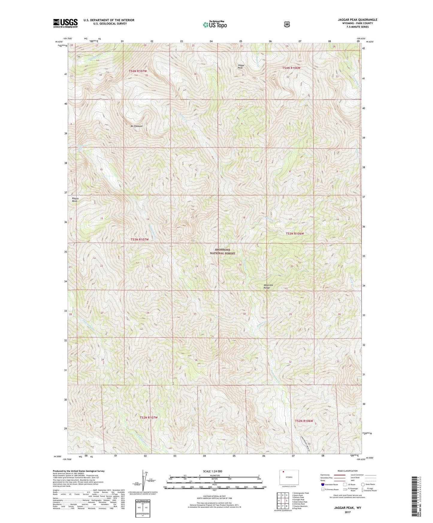
Jaggar Peak Wyoming US Topo Map
Couldn't load pickup availability
Also explore the Jaggar Peak Forest Service Topo of this same quad for updated USFS data
2021 topographic map quadrangle Jaggar Peak in the state of Wyoming. Scale: 1:24000. Based on the newly updated USGS 7.5' US Topo map series, this map is in the following counties: Park. The map contains contour data, water features, and other items you are used to seeing on USGS maps, but also has updated roads and other features. This is the next generation of topographic maps. Printed on high-quality waterproof paper with UV fade-resistant inks.
Quads adjacent to this one:
West: Sunlight Peak
Northwest: Stinkingwater Peak
North: Geers Point
Northeast: Elkhorn Peak
East: Dead Indian Peak
Southeast: Flag Peak
South: Clayton Mountain
Southwest: Chimney Rock
This map covers the same area as the classic USGS quad with code o44109e6.
Contains the following named places: Jaggar Peak, Mount Pleasant, Peanut Creek, Sweetwater Creek Falls, Sweetwater Mineral Springs, Turret Creek, Wilson Creek, Winona Camp