MyTopo
Clayton Mountain Wyoming US Topo Map
Couldn't load pickup availability
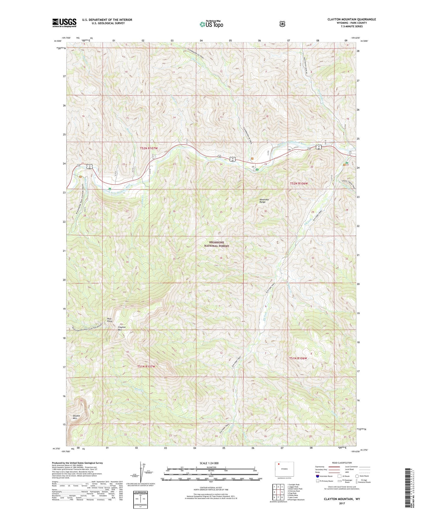
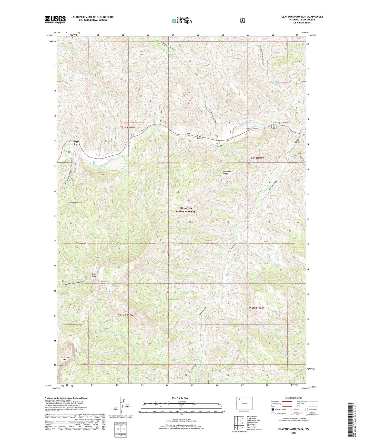
2021 topographic map quadrangle Clayton Mountain in the state of Wyoming. Scale: 1:24000. Based on the newly updated USGS 7.5' US Topo map series, this map is in the following counties: Park. The map contains contour data, water features, and other items you are used to seeing on USGS maps, but also has updated roads and other features. This is the next generation of topographic maps. Printed on high-quality waterproof paper with UV fade-resistant inks.
Quads adjacent to this one:
West: Chimney Rock
Northwest: Sunlight Peak
North: Jaggar Peak
Northeast: Dead Indian Peak
East: Flag Peak
Southeast: Ptarmigan Mountain
South: Lake Creek
Southwest: Sheep Mesa
Contains the following named places: Aspen Creek, Aspen Creek Summer Homes, Blackwater Creek, Blackwater Lodge, Blackwater Pond Picnic Ground, Blind Creek, Clayton Mountain, Clearwater campground, Clearwater Creek, Clearwater Picnic Area, Cougar Creek, Double Mountain, Elk Fork, Elk Fork Campground, Elk Fork Creek Watershed Project, Firefighter Monument, Frost Creek, Grace Creek, Icy Creek, June Creek, Moss Creek, Post Point, Rex Hale Campground, Sweetwater Creek, Sweetwater Creek Mine, UXU Lodge, Wapiti Campground