MyTopo
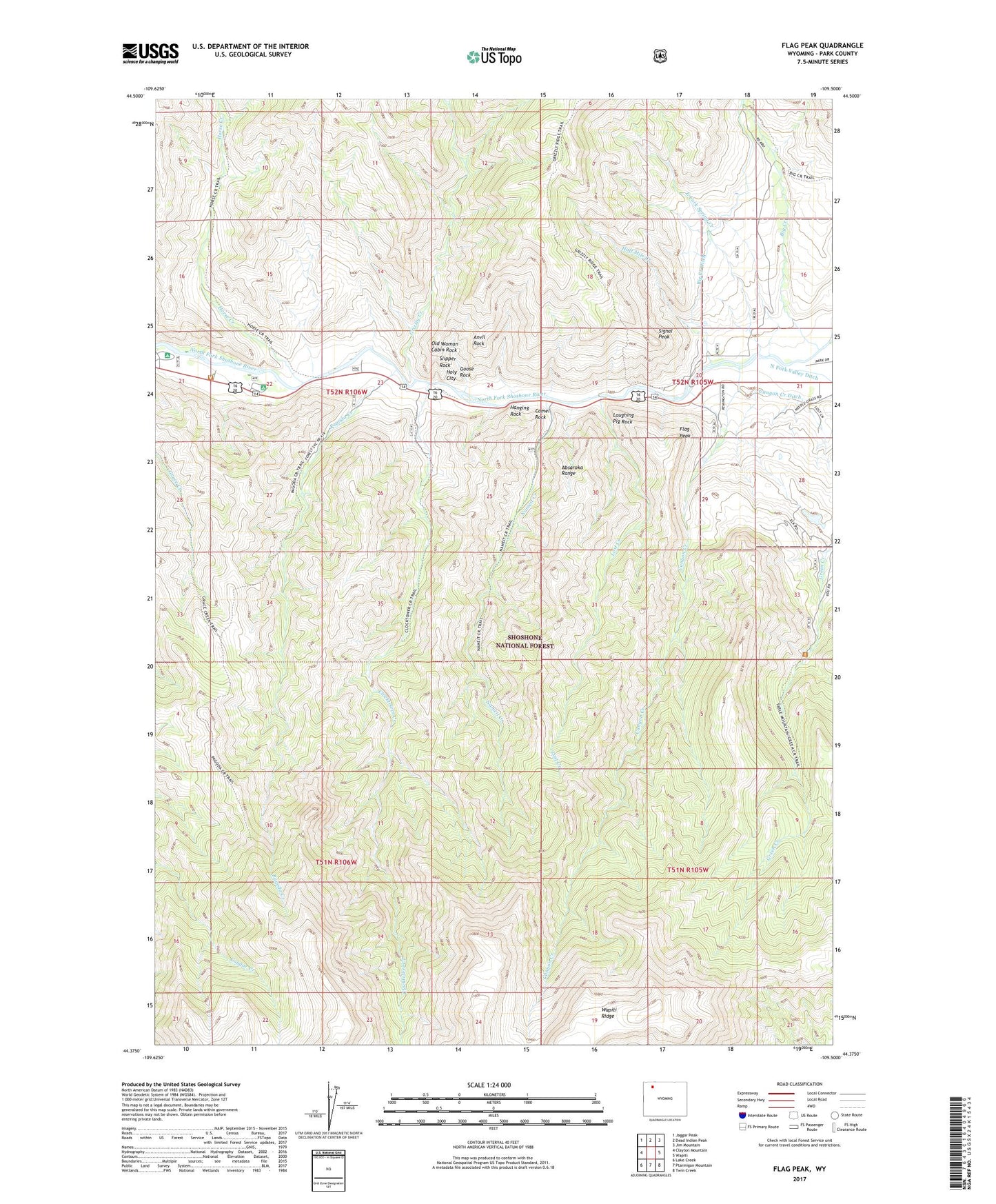
Flag Peak Wyoming US Topo Map
Couldn't load pickup availability
Also explore the Flag Peak Forest Service Topo of this same quad for updated USFS data
2021 topographic map quadrangle Flag Peak in the state of Wyoming. Scale: 1:24000. Based on the newly updated USGS 7.5' US Topo map series, this map is in the following counties: Park. The map contains contour data, water features, and other items you are used to seeing on USGS maps, but also has updated roads and other features. This is the next generation of topographic maps. Printed on high-quality waterproof paper with UV fade-resistant inks.
Quads adjacent to this one:
West: Clayton Mountain
Northwest: Jaggar Peak
North: Dead Indian Peak
Northeast: Jim Mountain
East: Wapiti
Southeast: Twin Creek
South: Ptarmigan Mountain
Southwest: Lake Creek
This map covers the same area as the classic USGS quad with code o44109d5.
Contains the following named places: Anvil Rock, Big Creek, Big Creek Ditch, Big Game Campground, Camel Rock, Canyon Creek, Canyon Creek Ditch, Circle H Ranch, Clocktower Creek, East Fork Spring Creek, Flag Peak, Goose Rock, Green Creek Summer Homes, Grizzly Creek, Grizzly Ranch, Half Mile Creek, Hanging Rock, Hanging Rock Campground, Holy City, Horse Creek, Horse Creek Camp Ground, Horse Creek Picnic Area, Laughing Pig Rock, Lost Creek, Nameit Creek, Old Woman Cabin Rock, Pagoda Creek, Pagoda Creek Summer Homes, Rimrock Ranch, Signal Peak, Slipper Rock, Valley Ditch, Wapiti Campground, Wapiti Ranger Station, ZIP Code: 82414