MyTopo
Cloud Peak Wyoming US Topo Map
Couldn't load pickup availability
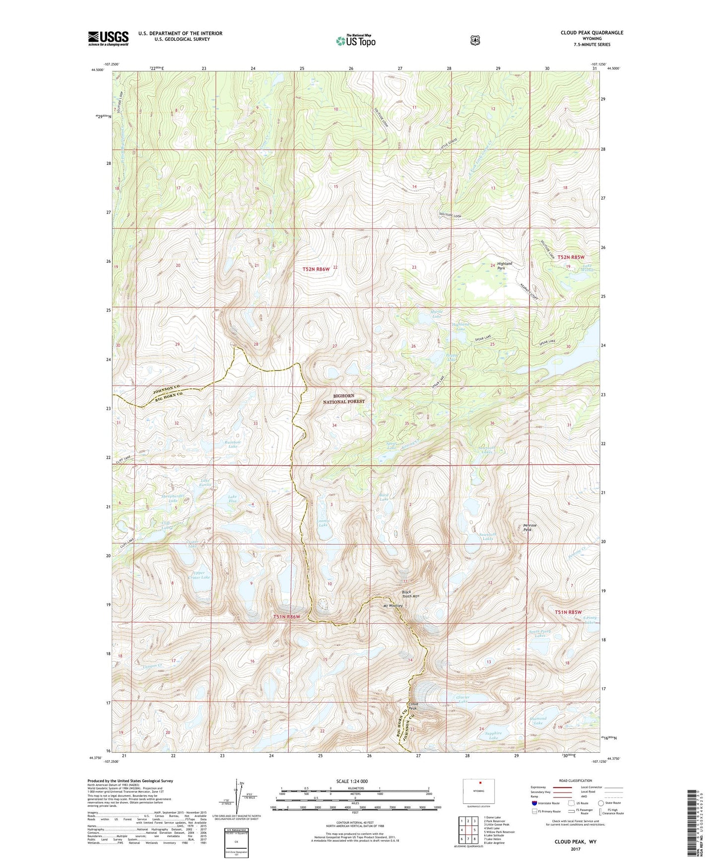
2021 topographic map quadrangle Cloud Peak in the state of Wyoming. Scale: 1:24000. Based on the newly updated USGS 7.5' US Topo map series, this map is in the following counties: Johnson, Big Horn. The map contains contour data, water features, and other items you are used to seeing on USGS maps, but also has updated roads and other features. This is the next generation of topographic maps. Printed on high-quality waterproof paper with UV fade-resistant inks.
Quads adjacent to this one:
West: Shell Lake
Northwest: Dome Lake
North: Park Reservoir
Northeast: Little Goose Peak
East: Willow Park Reservoir
Southeast: Lake Angeline
South: Lake Helen
Southwest: Lake Solitude
Contains the following named places: Bard Lake, Black Tooth Mountain, Cliff Lake, Cliff Lake Trail, Cloud Peak, Cloud Peak Wilderness, Crater Lake, Cross Creek Lakes, Diamond Lake, Glacier Lake, Highland Lake, Highland Park, Highland Park Campground, Highland Park Lakes, Kearney Lake, Kearny Lake Reservoir, Lake Elsa, Lake Eunice, Lake Winnie, Loomis Lake, Mount Woolsey, Myrtle Lake, Peggy Lake, Penrose Peak, Rainbow Lake, Sapphire Lake, Sawtooth Lakes, Sheepherder Lake, South Piney Lakes, Spear Lake, Upper Crater Lake