MyTopo
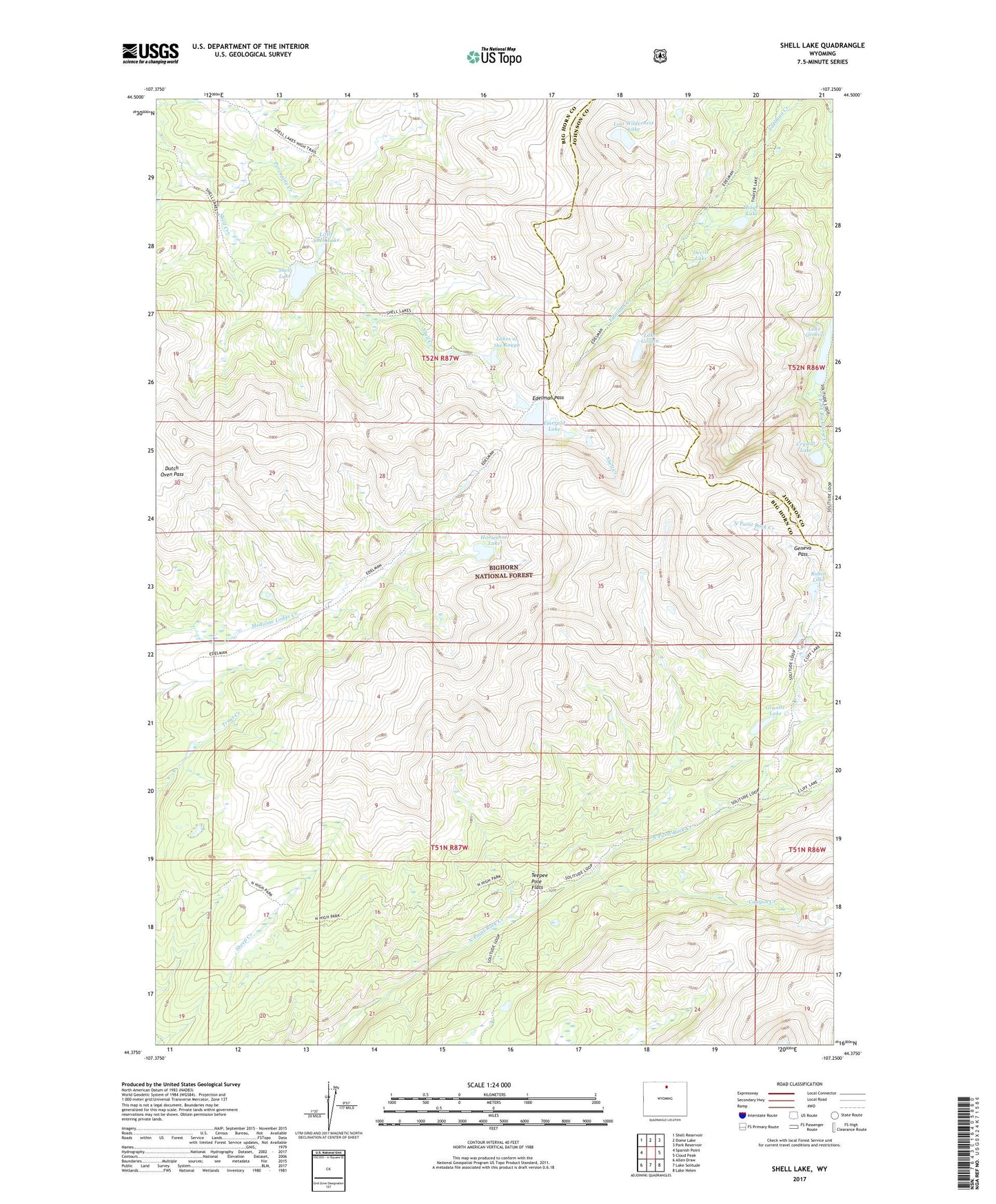
Shell Lake Wyoming US Topo Map
Couldn't load pickup availability
Also explore the Shell Lake Forest Service Topo of this same quad for updated USFS data
2021 topographic map quadrangle Shell Lake in the state of Wyoming. Scale: 1:24000. Based on the newly updated USGS 7.5' US Topo map series, this map is in the following counties: Big Horn, Johnson. The map contains contour data, water features, and other items you are used to seeing on USGS maps, but also has updated roads and other features. This is the next generation of topographic maps. Printed on high-quality waterproof paper with UV fade-resistant inks.
Quads adjacent to this one:
West: Spanish Point
Northwest: Shell Reservoir
North: Dome Lake
Northeast: Park Reservoir
East: Cloud Peak
Southeast: Lake Helen
South: Lake Solitude
Southwest: Allen Draw
This map covers the same area as the classic USGS quad with code o44107d3.
Contains the following named places: Canyon Creek, Crystal Lake, Devils Lake, Dutch Oven Pass, Edelman Pass, Edelman Trail, Emerald Lake, Geneva Pass, Granite Lake, Horseshoe Lake, Lake Geneva, Lake Geneva Campground, Lake Golden, Lakes of the Rough, Little Shell Lake, Lost Wilderness Lake, North High Park Trail, Porcupine Creek, Robin Lake, Shell Lake, Teepee Pole Flats, Thayer Lake