MyTopo
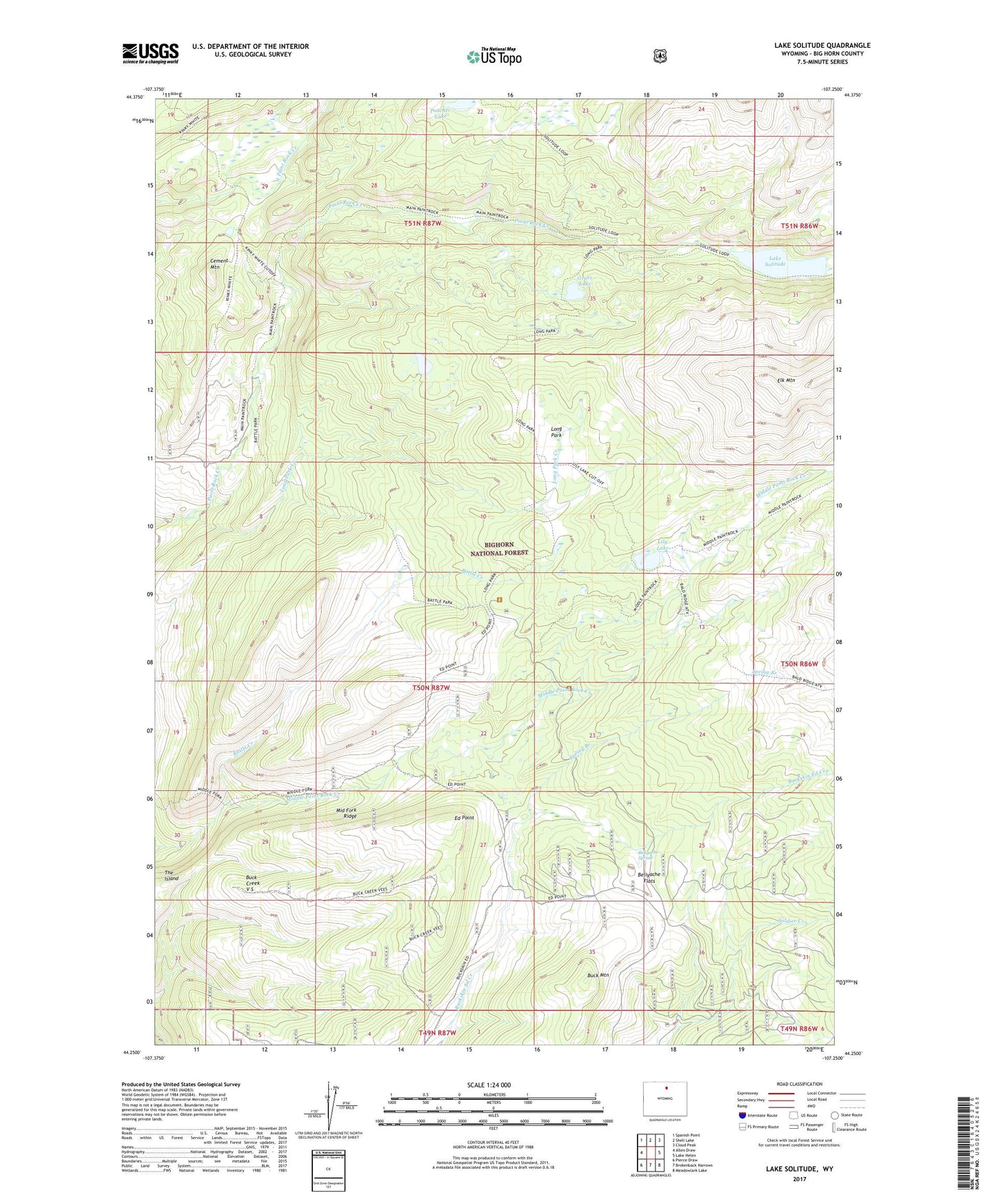
Lake Solitude Wyoming US Topo Map
Couldn't load pickup availability
Also explore the Lake Solitude Forest Service Topo of this same quad for updated USFS data
2021 topographic map quadrangle Lake Solitude in the state of Wyoming. Scale: 1:24000. Based on the newly updated USGS 7.5' US Topo map series, this map is in the following counties: Big Horn. The map contains contour data, water features, and other items you are used to seeing on USGS maps, but also has updated roads and other features. This is the next generation of topographic maps. Printed on high-quality waterproof paper with UV fade-resistant inks.
Quads adjacent to this one:
West: Allen Draw
Northwest: Spanish Point
North: Shell Lake
Northeast: Cloud Peak
East: Lake Helen
Southeast: Meadowlark Lake
South: Brokenback Narrows
Southwest: Pierce Draw
This map covers the same area as the classic USGS quad with code o44107c3.
Contains the following named places: Battle Creek, Battle Park, Bellyache Flats, Bellyache Spring, Buck Creek Cow Camp, Buck Creek V S, Buck Mountain, Cement Mountain, Crain Camp, Ed Point, Elk Mountain, Grace Lake, Hyatt Cow Camp, Kinky White Trail, Lake Solitude, Lily Lake, Long Park, Long Park Creek, Lost Lake, Main Paint Rock Trail, Middle Fork Ridge, Poacher Lake, Spring Branch