MyTopo
Dome Lake Wyoming US Topo Map
Couldn't load pickup availability
Also explore the Dome Lake Forest Service Topo of this same quad for updated USFS data
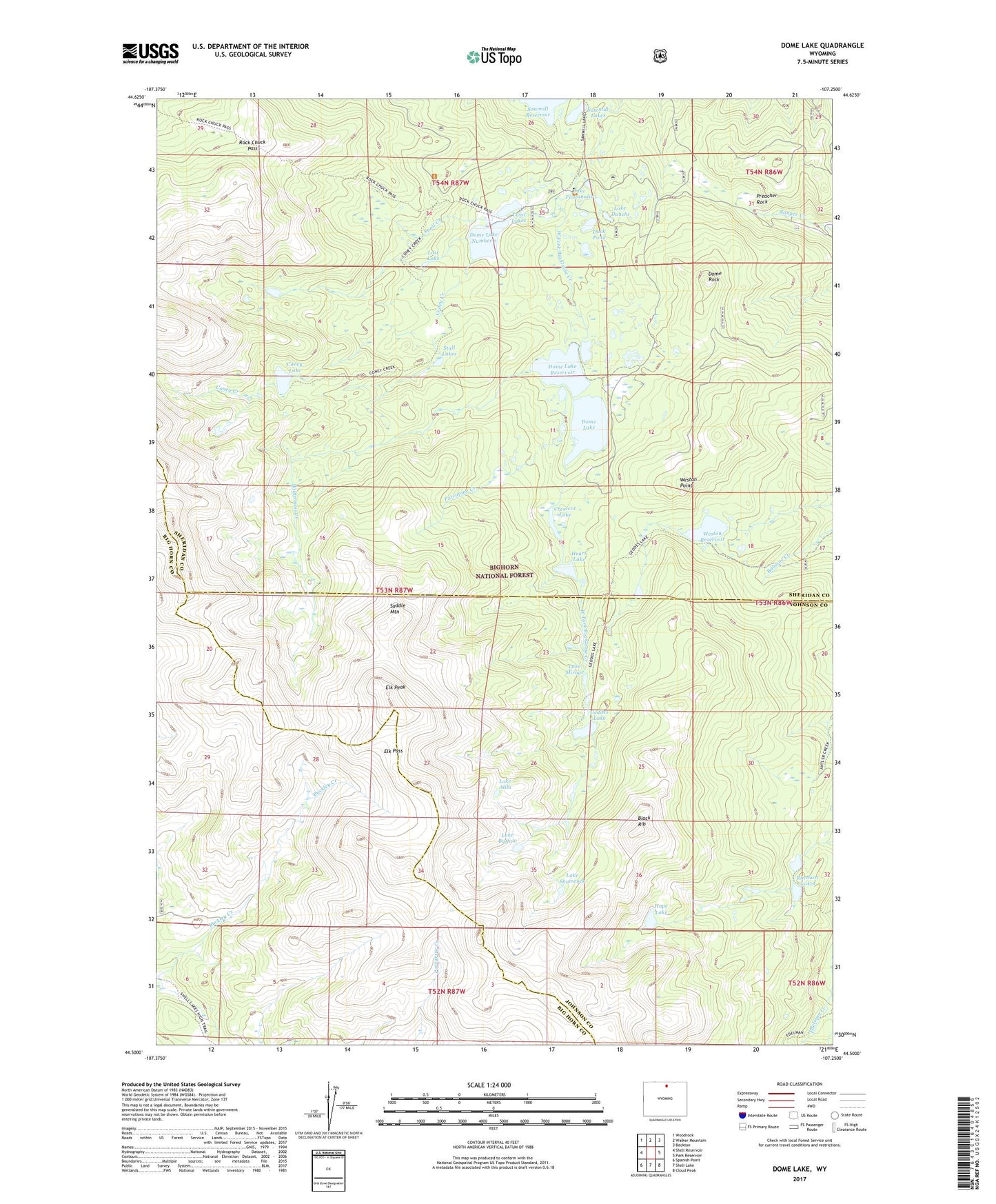
2021 topographic map quadrangle Dome Lake in the state of Wyoming. Scale: 1:24000. Based on the newly updated USGS 7.5' US Topo map series, this map is in the following counties: Sheridan, Johnson, Big Horn. The map contains contour data, water features, and other items you are used to seeing on USGS maps, but also has updated roads and other features. This is the next generation of topographic maps. Printed on high-quality waterproof paper with UV fade-resistant inks.
Quads adjacent to this one:
West: Shell Reservoir
Northwest: Woodrock
North: Walker Mountain
Northeast: Beckton
East: Park Reservoir
Southeast: Cloud Peak
South: Shell Lake
Southwest: Spanish Point
This map covers the same area as the classic USGS quad with code o44107e3.
Contains the following named places: Bighorn Mountains, Bighorn National Forest, Black Rib, Coney Creek, Coney Lake, Crescent Lake, Dome Lake, Dome Lake Number 1, Dome Lake Number 1 Dam, Dome Lake Reservoir, Dome Rock, Duck Pond, Edelman Creek, Elk Pass, Elk Peak, Geddes Lake, Grubstake Syndicate Mine, Heart Lake, Hope Lake, Lake Alibi, Lake Buffalo, Lake Dunchi, Lake Fontanalis, Lake Mirage, Lake Shamrock, Lost Lake, Porcupine Creek, Preacher Rock, Rinehart Lakes, Rock Chuck Pass, Saddle Mountain, Sawmill Dam, Sawmill Lakes, Snail Creek, Stull Lakes, Twin Lakes, Twin Lakes Campground, Twin Lakes Number 1 Dam, Twin Lakes Number 2, Twin Lakes Number 2 Dam, Twin Lakes Picnic Area, Weston Dam, Weston Point, Weston Reservoir, Wilderness Creek