
MyTopo
Cow Creek Mountain Wyoming US Topo Map
Couldn't load pickup availability
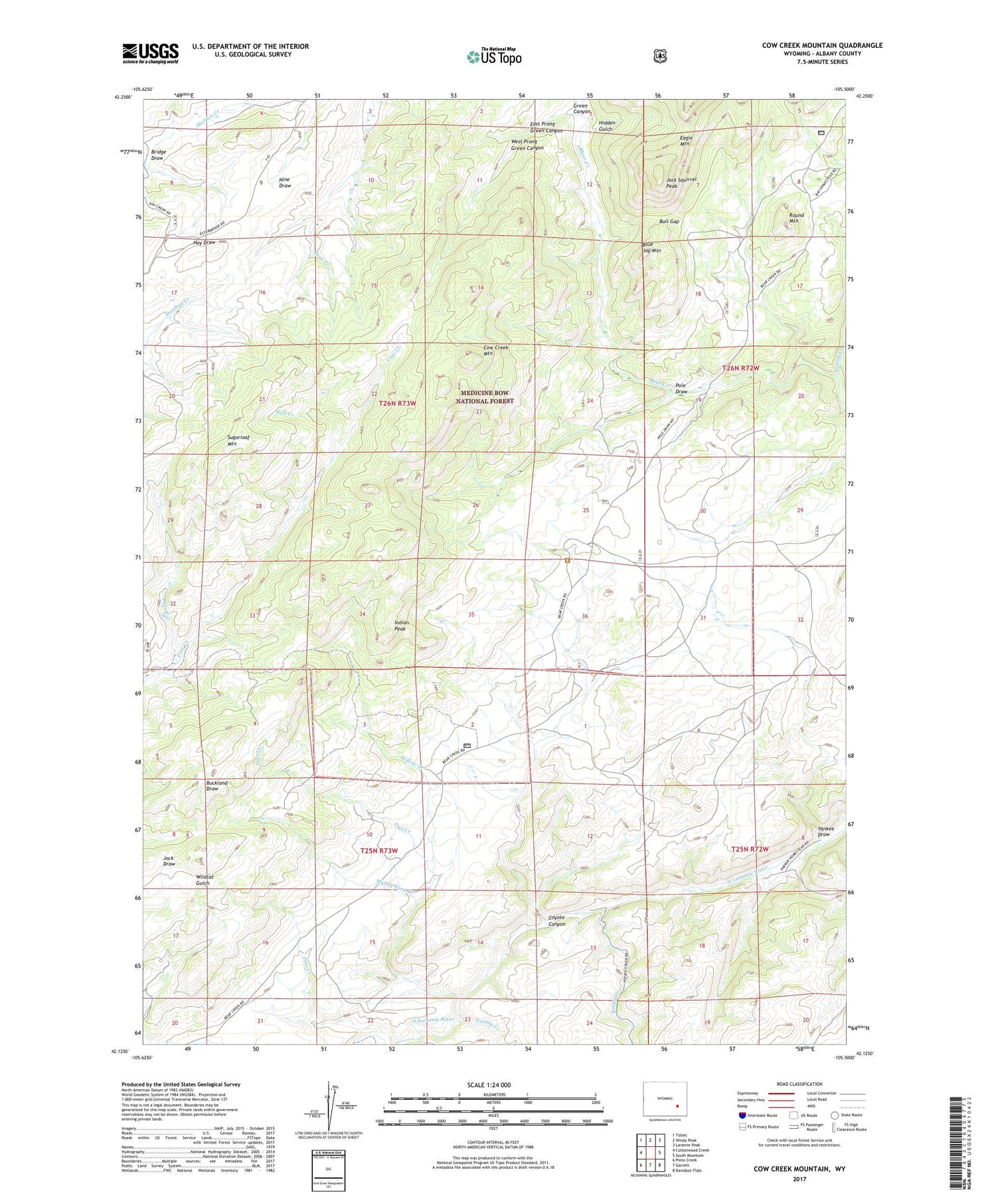
2021 topographic map quadrangle Cow Creek Mountain in the state of Wyoming. Scale: 1:24000. Based on the newly updated USGS 7.5' US Topo map series, this map is in the following counties: Albany. The map contains contour data, water features, and other items you are used to seeing on USGS maps, but also has updated roads and other features. This is the next generation of topographic maps. Printed on high-quality waterproof paper with UV fade-resistant inks.
Quads adjacent to this one:
West: Cottonwood Creek
Northwest: Toltec
North: Windy Peak
Northeast: Laramie Peak
East: South Mountain
Southeast: Davidson Flats
South: Garrett
Southwest: Pinto Creek
Contains the following named places: Blue Jay Mountain, Bob Garett Cow Camp, Bull Creek, Bull Gap, Burnett Cow Camp, Cow Creek Mountain, Coyote Canyon, Deer Creek, East Prong Green Canyon, Friend Creek, Green Canyon, Hidden Gulch, Indian Peak, Jack Squirrel Peak, Muddy Ford Creek, Owl Creek, Pine Creek, Pole Draw, Potato Creek, Round Mountain, Sugarloaf Mountain, Tweety Creek, West Prong Green Canyon, Willow Creek, Yankee Draw


