MyTopo
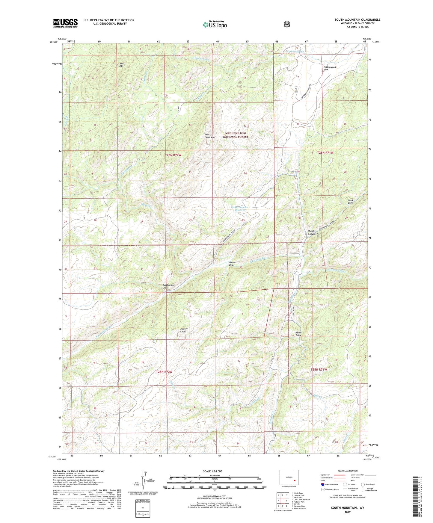
South Mountain Wyoming US Topo Map
Couldn't load pickup availability
Also explore the South Mountain Forest Service Topo of this same quad for updated USFS data
2021 topographic map quadrangle South Mountain in the state of Wyoming. Scale: 1:24000. Based on the newly updated USGS 7.5' US Topo map series, this map is in the following counties: Albany. The map contains contour data, water features, and other items you are used to seeing on USGS maps, but also has updated roads and other features. This is the next generation of topographic maps. Printed on high-quality waterproof paper with UV fade-resistant inks.
Quads adjacent to this one:
West: Cow Creek Mountain
Northwest: Windy Peak
North: Laramie Peak
Northeast: Harris Park
East: Fletcher Park
Southeast: Reese Mountain
South: Davidson Flats
Southwest: Garrett
This map covers the same area as the classic USGS quad with code o42105b4.
Contains the following named places: Arapaho Creek, Bear Creek, Bear Head Mountain, Clark Draw, Cottonwood Park, Double Four Ranch, Felix Creek, Kloer Creek, Menter Draw, Menter Knob, Merril Draw, Murphy Canyon, Parker Number 1 Dam, Parker Number 1 Reservoir, Rattlesnake Draw, Rees Creek, Reservoir Creek, Siebolt Creek, South Mountain, Sturgeon Creek